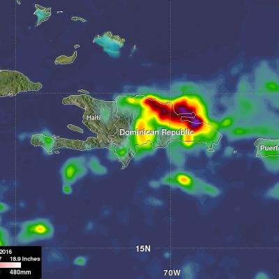
Tropical Storm Otto Develops, Threatens Central America
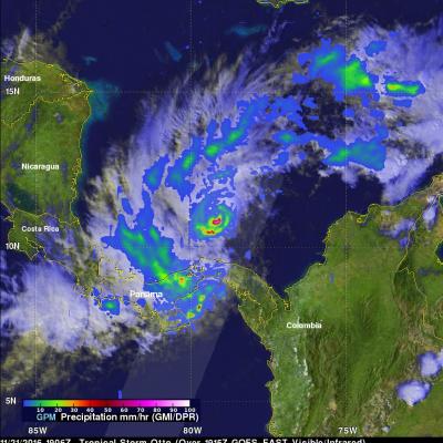
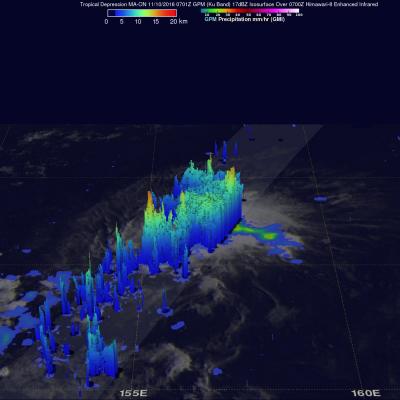
Tropical storm Otto formed in the southwestern Caribbean north of Panama on November 21, 2016. The GPM core observatory satellite had an excellent daytime view of the newly formed tropical storm on November 21, 2016 at 1906 UTC (2:06 PM EST). Otto had wind speeds estimated at 45 kts (52 mph) at that time. GPM satellite rainfall data are shown overlaid on a visible and infrared image captured by the GOES-EAST satellite at 1915 UTC (2:15 PM EST). GPM's Microwave Imager (GMI) and Dual-Frequency Precipitation Radar (DPR) revealed that the newly formed tropical storm had deep convective bursts in