What is the difference between a tornado and a hurricane?

Both tornadoes and hurricanes are characterized by extremely strong horizontal winds that swirl around their center and by a ring of strong upward motion surrounding downward motion in their center. In both tornadoes and hurricanes, the tangential wind speed far exceeds the speed of radial inflow or of vertical motion.

Hurricanes always and tornadoes usually rotate counterclockwise in the northern hemisphere and clockwise in the southern hemisphere. The Earth's rotation determines this direction for the storms' rotation in each hemisphere. Local winds are sometimes able to cause a tornado to form that spins in the opposite direction from the typical direction for that hemisphere.

The most obvious difference between a tornado and hurricane is that a hurricane's horizontal scale is about a thousand times larger than a tornado. In addition, hurricanes and tornadoes form under different circumstances and have different impacts on the atmosphere.

Tornadoes are small-scale circulations, that are rarely more than a few hundred feet across when they touch the ground. Most tornadoes grow out of severe thunderstorms that develop in the high wind-shear environment of the United States Central Plains during spring and early summer.  Many tornadoes form when the large-scale wind flow leads to a violent clash between moist, warm air traveling north from the Gulf of Mexico and cold, dry, continental air coming from the United States Northwest. Tornadoes can also form in many other locations and from other forcing factors. For example, a hurricane making landfall may trigger many tornadoes to form.

Tornado wind speeds may reach 100 to 300 mph and cause havoc on the ground, but tornadoes typically last only a few minutes and rarely travel more than 10 or 20 miles along the ground. Tornadoes have little impact on storms that spawn them or collectively on the global circulation of the atmosphere.

Hurricanes, on the other hand, are large-scale circulations that are 60 to over 1,000 miles across. Hurricanes form near the Equator, generally between 5 and 20 degrees latitude, but never right on the Equator. Hurricanes always form over the warm waters of the tropical oceans and generally where the sea-surface temperature exceeds 26.5°C (76°F).

A hurricane may travel thousands of miles and persist over several days or weeks. During its lifetime, a hurricane will transport a significant amount of heat up from the ocean surface and into the upper troposphere or even lower stratosphere. Even though hurricanes form only sporadically, they do affect the global atmosphere's circulation in measurable ways, although this is still an active area of research.

Extreme Weather News

Jump to a Year

2022 | 2021 | 2020 | 2019 | 2018

2017 | 2016 | 2015 | 2014 | 2013

2012 | 2011 | 2010 | 2009 | 2008

2007 | 2006 | 2005 | 2004 | 2003

2002

GPM Sees Super Typhoon Melor Hitting The Philippines

Super typhoon Melor (known in the Philippines as Nona) formed east of the Philippines on December 12, 2015. Melor became more powerful and became a typhoon the next day while heading toward the Philippines. The Joint Typhoon Warning Center (JTWC) indicated that Melor was a super typhoon with winds of 115 kts 115 kts (133 mph) just before hitting the Philippines .The GPM core observatory satellite passed above as super typhoon Melor was impacting the Philippines on December 14, 2015 at 1006 UTC. At that time Melor still had maximum sustained winds of about 115 kts (133 mph). Rainfall derived

Tropical Cyclone 05S Viewed By GPM

Tropical cyclone 05S formed today in the South Indian Ocean well to the northeast of the islands of Reunion and Mauritius. The GPM core observatory satellite had a perfect view of 05S when the satellite flew over on December 9, 2015 at 1416 UTC. At that time the forming tropical cyclone had sustained winds estimated at 35 kts (40 mph). GPM found that 05S was dropping rain at a rate of over 77 mm (~ 3 inches) per hour in strong convective storms near the tropical cyclone's center of circulation. GPM also saw intense rainfall in a strong feeder band that was converging into the storm's

Northwest's Extreme Rainfall Checked By IMERG

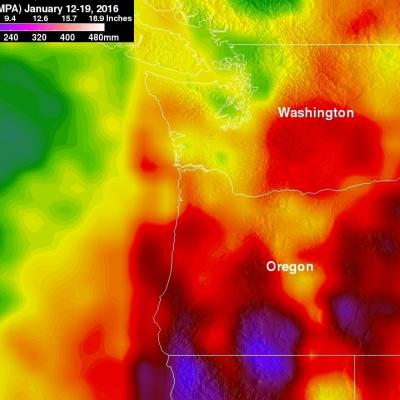
During the past week moisture from the tropics has been pumped into the Pacific Northwest by the "Pineapple Express". Resulting extreme rainfall has led to widespread flooding and landslides. The continued "training" of rainfall into the area has caused flooding in the Portland, Oregon area with at least one death reported. Western Washington is also on flood alert due to the deluge. Rainfall that occurred during the past week (December 2-9, 2015) was measured with data from NASA's Integrated Multi-satellitE Retrievals for GPM (IMERG). IMERG found that many areas from northern California

IMERG Measures Flooding Rainfall In Northwest England

In addition to destructive winds measured at 81 mph (70 kts) a powerful winter storm called Desmond dropped record rainfall in northwest England over the past weekend. Desmond's unusually heavy rainfall resulted in wide spread damaging floods. Data from NASA's Integrated Multi-satellitE Retrievals for GPM (IMERG) were used to estimate rainfall for the period from November 30 to December 7, 2015. This analysis found that some rainfall near the Irish Sea measured over 392 mm (~15.4 inches) during this period. As much as 304 mm (~12 inches) of rain were reported to have fallen in only 24 hours

NASA's IMERG Adds Up More of Southern India's Extreme Rainfall

Data from the Global Precipitation Measurement or GPM mission core satellite were used to help estimate rainfall data. GPM is a satellite co-managed by both NASA and the Japan Aerospace Exploration Agency. The city of Chennai on India's southeastern coast was hit particularly hard. More than 260 deaths have been reported in the Indian state of Tamil Nadu. Data from NASA's Integrated Multi-satellitE Retrievals for GPM (IMERG) were used to estimate the flooding rainfall that fell from November 28 to Dec. 4, 2015. Over 400 mm (15.7 inches) of rainfall were estimated over areas south of Chennai