Images and caption by Hal Pierce (SSAI/NASA GSFC)

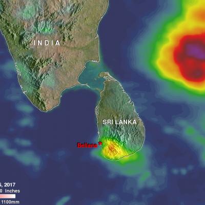
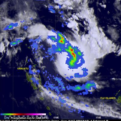
Cyclone Mora Examined By GPM

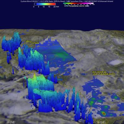
The GPM core observatory satellite passed over cyclone Mora on May 30, 2017 at 1121 UTC. Mora had passed into southeastern Bangladesh less than six hours earlier. Maximum sustained winds within Mora were estimated to be about 55 kts (63 mph) when GPM passed above. Data received by GPM's Microwave Imager (GMI) and Dual-Frequency Precipitation Radar (DPR) instruments revealed the location and intensity of rainfall around the dissipating cyclone. GPM's radar swath, shown in lighter shades, covered the area west of the dissipating cyclone's center. GPM's DPR found that rain was still falling at a

Heavy Rainfall Induced Landslide Observed By IMERG

More than 90 people have been reported killed and over 100 missing due to a landslide in the village of Bellana, in the Kalutara district of Sri Lanka. Heavy monsoon rainfall over the past few days caused the disaster. Heavy rainfall is shown over the southwestern Bay Of Bengal in this analysis of rainfall accumulation using NASA's Integrated Multi-satellitE Retrievals for GPM (IMERG) data. This IMERG analysis included the period from May 23 to early May 26, 2017. The maximum IMERG rainfall accumulation estimates in this area were shown in the Bay Of Bengal to the northeast of Sri Lanka where

Tornado Spawning Storms Examined By GPM Satellite

On Wednesday May 24, 2017 severe weather affected a large area of the eastern United States. Tornadoes were reported in Florida, Georgia, South Carolina, North Carolina and Ohio. The GPM core observatory satellite flew above a line of tornado spawning storms that were moving through the Florida panhandle on May 24, 2017 at 10:26 AM EDT ( 1426 UTC). GPM's Microwave Imager (GMI) and Dual-Frequency Precipitation Radar (DPR) instruments collected data showing that very heavy downpours were accompanying some of these storms. The violent storms moving through the Southeast were strong but GPM's

GPM Sees Powerful Storms With Advancing Monsoon

The GPM core observatory satellite passed over the Bay Of Bengal on May 23, 2017 at 0251 UTC. GPM flew almost directly above very strong convective storms that were located east of Sri Lanka. These powerful storms were associated with the approaching South-West monsoon. The amount and timing of monsoon rainfall is very important to the economy of India. GPM's Microwave Imager (GMI) and Dual-Frequency Precipitation Radar (DPR) instruments collected data that showed the location and intensity of rainfall in the southern Bay Of Bengal. Very heavy rainfall was detected within this cluster of

IMERG Sees Record Australia Rainfall

Over the past week extreme rainfall has drenched northeastern Australia. This is the heaviest rainfall in that area since tropical cyclone Debbie hit Queensland Australia in late March. Much of the recent extremely heavy rainfall was due to storms associated with a trough of low pressure slowly moving over northeastern Queensland from the Coral Sea. More than 100mm (3.9 inches) of rain in 24 hours was reported near Townsville in northern Queensland. A trough of low pressure moving eastward from central Australia has also been encroaching into western Queensland. This analysis of rainfall over

Heavy Rainfall In The Caribbean Measured By IMERG

Heavy rainfall has recently caused widespread flooding and landslides in Jamaica. Occasional showers from trade winds are normal in Jamaica but recent rainfall from slow moving troughs have been unusually heavy. A 1009 mb low pressure center located in the western Caribbean was disrupting the normal trade winds over Jamaica today. This rainfall analysis was constructed using data from NASA's Integrated Multi-satelliE Retrievals for GPM (IMERG). Data collected in near-real time were utilized in IMERG's rainfall accumulation estimates for the Caribbean. This analysis covers the period from May

Tropical Cyclone Donna's Extreme Rainfall Evaluated With IMERG

On May 10, 2017 rapidly dissipating tropical Cyclone Donna moved to the southeast of New Caledonia in the South Pacific. In addition to being the most powerful out-of-season tropical cyclone ever recorded in the southern hemisphere, Donna also dropped extreme amounts of rainfall along it's path. Donna spread heavy rainfall along it's path from northern Vanuatu through the Loyalty Islands east of New Caledonia. Over 250mm (~10 inches) of rainfall was reported in the islands of northern Vanuatu as Donna was moving through on May 5, 2017. This rainfall analysis was constructed using data from

GPM Sees Intensifying Ella

The GPM core observatory satellite flew over intensifying tropical cyclone Ella in the South Pacific on May 10, 2017 at 2301 UTC. The satellite's Microwave Imager (GMI) and Dual-Frequency Precipitation Radar (DPR) instruments showed bands of curved rainfall bands wrapping into the center of a well defined center of circulation. GPM's DPR measured rain falling at a rate of over 231 mm (9.1 inches) per hour in an intense feeder band on Ella's eastern side. This 3-D view of tropical cyclone Ella was produced using GPM radar reflectivity data (DPR Ku Band). DPR showed that the highest storm tops

GPM Monitors Tropical Cyclone Donna

The above window displays an interactive visualization of GPM data collected from Tropical Cyclone Donna on 5/7/17. Over the weekend tropical cyclone Donna dropped very heavy rain over Vanuatu as it moved toward the west of the islands. Donna had intensified and had maximum sustained winds of 115 kts (132 mph) on Monday morning. This made it the equivalent of a category four on the Saffir-Simpson hurricane wind scale. The GPM core observatory satellite had two excellent views of the intensifying tropical cyclone Donna on succeeding days. When GPM flew over Donna on May 6, 2017 at 0146 UTC the

Tropical Cyclone Donna's Rain Unveiled By GPM

Tropical Cyclone Donna formed in the South Pacific Ocean northeast of Vanuatu On May 2, 2017 at 1800 UTC. A few hours earlier at 1521 UTC the GPM core observatory satellite passed above that area. GPM's Microwave Imager (GMI) instrument provided a clear view of the rainfall associated with the forming tropical cyclone. GMI revealed that an intense rain band was wrapping into the center of the forming tropical cyclone from the northern side. GMI data indicated that precipitation in one of these intense rain bands was falling at a rate of over 53 mm (~2 inches) per hour. GPM's Dual-Frequency