Articles

GPM Catches Typhoon Yutu Making Landfall
NASA's GPM Core observatory satellite captured an image of Super Typhoon Yutu when it flew over the powerful storm just as the center was striking the central Northern Mariana Islands north of Guam. Early Thursday, Oct. 25 local time, Super Typhoon Yutu crossed over the U.S. commonwealth of the Northern Mariana Islands. It was the equivalent of a Category 5 hurricane. The National Weather Service in Guam said it was the strongest storm to hit any part of the U.S. this year. 
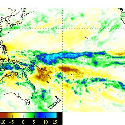
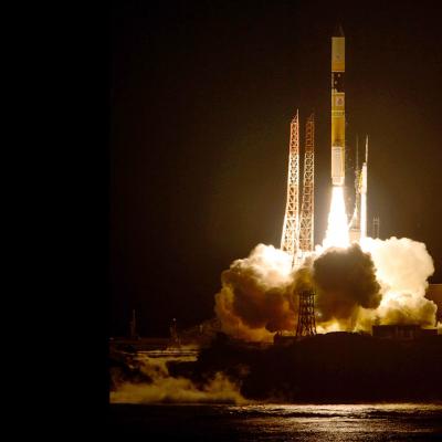
Download this video in high resolution from the NASA Goddard Scientific Visualization Studio Download video without...
Dive Into a 360-View of Hurricane Maria
Two days before Hurricane Maria devastated Puerto Rico, the NASA/JAXA Global Precipitation Measurement Core Observatory satellite captured a 3D view of the 2017 storm. At the time Maria was a category 1 hurricane. The 3-D view reveals the processes inside the hurricane that would fuel the storm’s intensification to a category 5 storm within 24 hours. For the first time in 360 degrees, this data visualization takes you inside the hurricane. The precipitation satellite has an advanced radar that measures both liquid and frozen water. The brightly colored dots show areas of rainfall, where green...
GPM flying over Earth with a data swath visualized.
We Want You to Go to Class! Our students desperately need to have some face to face time with scientists and engineers who are doing amazing things to make their world a better place. That means you guys! From time to time, you may be invited to give a presentation on your work to kids in some context- and we want to make it easier for you. You might even reach out yourself to your local school and offer to come in and give a talk. Having been a classroom teacher across all grade levels by the time I finished my illustrious career, I know personally the joy of having real STEM professionals...
GPM Applications Banner: Disasters
Too much or too little rainfall can have significant impacts on populations around the world. As population and global temperatures increase, it is crucial to understand what locations will become more vulnerable to extreme rainfall and drought and the subsequent natural hazards (e.g., landslides) and risks (e.g., lose of property) they impose. Satellites allow us to monitor changes in the precipitation, especially over oceans and regions where ground-based data are sparse. With its near-real-time precipitation estimates and near global coverage, GPM serves as an essential tool for assessing
GPM Applications: Health
Precipitation extremes, from heavy rainfall to droughts, pose great risks to a country’s economic development and human health. Standing water and flooding resulting from heavy rainfall has created societal vulnerabilities to vector and waterborne disease outbreaks such as malaria, schistosomiasis, cholera, and chikungunya, among others. Drought and extreme heat conditions have been associated with a wide range of health hazards including degraded air and water quality. These meteorological extremes also impact the growth of cities such as damaging transportation networks and infrastructures