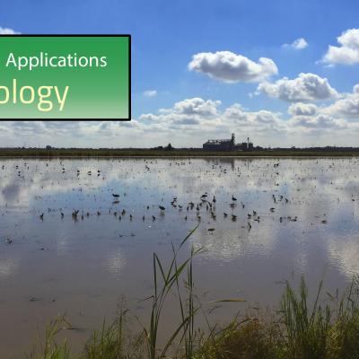
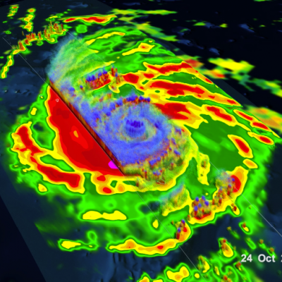
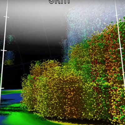
Articles

GPM Flies Over Tropical Cyclone Florence
Download in High Resolution from the NASA Goddard Scientific Visualization Studio GPM passed over Tropical Storm Florence on September 7, 2018. As the camera moves in on the storm, DPR's volumetric view of the storm is revealed. A slicing plane moves across the volume to display precipitation rates throughout the storm. Shades of green to red represent liquid precipitation. Frozen precipitation is shown in cyan and purple. NASA's Global Precipitation Measurement mission or GPM core observatory satellite flew over Tropical Storm Florence on September 7, 2018. At that time, the storm was...
NASA Rainfall Data and Global Fire Weather
The Global Fire WEather Database (GFWED) integrates different weather factors influencing the likelihood of a vegetation fire starting and spreading. It is based on the Fire Weather Index (FWI) System, which tracks the dryness of three general fuel classes, and the potential behavior of a fire if it were to start. Each day, FWI values are calculated from global weather data, including satellite rainfall data from the Global Precipitation Measurement (GPM) mission.
Using Precipitation Data to Track Cholera
Diarrheal diseases such as cholera continue to be a public health threat. Prediction of an outbreak of diarrheal disease, specifically cholera, following a natural disaster remains a challenge, especially in regions lacking basic safe civil infrastructure such as water, sanitation and hygiene (WASH). The underlying mechanism of a cholera outbreak is associated with disruption in the human access to safe WASH infrastructure that results in the population using unsafe water containing pathogenic vibrios. Presence and abundance of Vibrio cholerae, the causative agent of cholera, are related to modalities of the environment and regional weather as well as the climate systems.
GPM flying over Earth with a data swath visualized.
Registration for the GPM Disease Initiative Workshop has closed. You can view the workshop remotely by visiting this link on the day of the event: https://www.wilsoncenter.org/event/2018-vector-borne-and-water-related-…
Help NASA Create the Largest Landslide Database
Landslides cause thousands of deaths and billions of dollars in property damage each year. Surprisingly, very few centralized global landslide databases exist, especially those that are publicly available. Now NASA scientists are working to fill the gap—and they want your help collecting information.