TRMM News

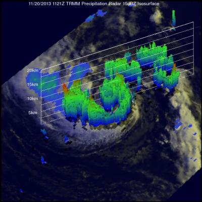
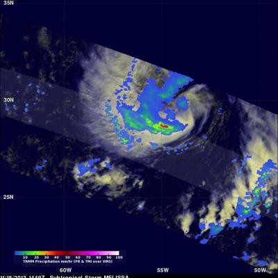
Tropical Cyclone Helen Hits India

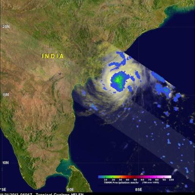
Tropical cyclone Helen was the fourth named tropical cyclone in the Bay Of Bengal this year when it formed on November 19, 2013. The image on the left shows tropical cyclone Helen as the TRMM satellite flew over on November 21, 2013 at 0606 UTC when Helen had reached peak intensity of about 60kts (~69 mph). The image on the right uses data captured on November 22, 2013 at 0510 UTC when tropical cyclone HELEN was hitting India's east-central coastline. Precipitation data derived from TRMM's Microwave Imager (TMI) and Precipitation Radar (PR) instruments show that Helen was dropping rain at a

Morning View of Tropical Storm Melissa

The TRMM satellite passed directly above tropical storm Melissa's center of circulation on November 20, 2013 at 1121 UTC (6:21 EST). TRMM's Precipitation Radar (PR) instrument found that rain was falling at a maximum rate of 55 mm/hr (~2.2 inches) in an area just to the southeast of Melissa's center of circulation. TRMM Precipitation Radar data were also used in the image on the right to show Melissa's 3-D structure. The tallest towers, reaching heights of over 13km (~8 km), were located in a band of rainfall to the northwest of Melissa's center. The strongest intensity radar echo of over

TRMM Views New Tropical Storm Melissa

The TRMM satellite flew above recently formed subtropical storm MELISSA in the central Atlantic Ocean on November 18, 2013 at 1449 UTC (9:49 AM EST). The image above shows rainfall data from TRMM's Microwave Imager (TMI) and Precipitation Radar (PR) overlaid on an enhanced visible/infrared image from TRMM's Visible and InfraRed Scanner (VIRS). This TRMM pass found that the heaviest rainfall within MELISSA was falling at a rate of over 74mm/hr (~2.9 inches) in an area of strong convective rainfall that was wrapping around the southern side of the storm. The National Hurricane Center (NHC)

Haiyan and Tropical Storm 30 Bring Heavy Rains to the Philippines

Super typhoon Haiyan, known locally in the Philippines as Yulonda, will go down as a historic storm, making landfall in the central Philippines as perhaps the most powerful tropical cyclone to ever make landfall with sustained winds estimated at 195 mph (~315 kph). So far, over 2300 people are confirmed to have been killed by the storm, and the number is likely to climb higher with many still missing and not all areas unaccounted for. Katrina, which devasted the US Gulf coast in 2005, was responsible for 1833 fatalities The most deadly flooding from Super Typhoon Haiyan was caused by the storm

Super Typhoon Haiyan Moving Toward The Philippines

As predicted by the Joint Typhoon Warning Center (JTWC) typhoon Haiyan became a powerful category five typhoon with sustained winds estimated to be over 135kts (~155 mph). Super typhoon Haiyan is predicted to strike the central Philippines in a few days. Super typhoon Haiyan was located just northeast of Palau when the TRMM satellite flew above on November 6, 2013 at 1026 UTC. A rainfall analysis from TRMM's Microwave Imager (TMI) and Precipitation Radar (PR) instruments is shown overlaid on an enhanced infrared image from TRMM's Visible and InfraRed Scanner (VIRS). Data from TRMM's TMI and PR

Typhoon Haiyan (31w) Develops East Of The Philippines

The Joint Typhoon Warning Center (JTWC) predicts that typhoon HAIYAN (31W) that developed east of the Philippines will become dangerous super typhoon HAIYAN with winds of 130kts (~150mph) before it hits the southern Philippines in about three days. The TRMM satellite had a good daytime view when it flew above tropical storm HAIYAN (31W) yesterday evening on November 4, 2013 at 2353 UTC. This image shows precipitation data collected with TRMM's Microwave Imager (TMI) and Precipitation Radar (PR) instruments overlaid on a combination visible and infrared image from TRMM's Visible and InfraRed

TRMM Has Second Look At Typhoon Krosa

On November 1, 2013 at 1320 UTC the TRMM satellite had the second look at typhoon KROSA. KROSA weakened slightly when it passed over the northern Philippines but had started to intensify with this second pass over the South China Sea. The image on the left shows rainfall data collected by TRMM's Microwave Imager (TMI) and Precipitation Radar (PR) instruments overlaid on an enhanced infrared image. TRMM PR data revealed that rain was falling at a rate of over 116mm/hr (4.5 inches) in KROSA's eye wall. Radar reflectivity values greater than 50dBZ were found in the same area. The 3-D perspective

Tropical Storm Raymond Fading Fast

There has been some recent convective activity within tropical storm Raymond but southwesterly wind shear and cooler ocean temperatures are predicted by the National Hurricane Center (NHC) to weaken the tropical storm to a remnant low on Wednesday October 30, 2013. Raymond contained rainfall only in an area northwest of it's center of circulation when the TRMM satellite passed above on October 28, 2013 at 2337 UTC (4:37 PM PDT). Rainfall data from TRMM's Microwave Imager (TMI) and Precipitation Radar (PR) are shown overlaid on a combination visible and infrared image from TRMM's Visible and

TRMM Sees Two Pacific Tropical Cyclones

Tropical Storm Lekima Tropical Storm Francisco The TRMM satellite flew above the centers of two tropical cyclones in the western Pacific Ocean early this morning. The first orbit saw super typhoon LEKIMA at 0745 UTC and with the next orbit tropical storm FRANCISCO came into view at 0919 UTC. Lekima was located southeast of tropical storm Francisco over the open waters of the Pacific. Precipitation data from TRMM's Microwave Imager (TMI) and Precipitation Radar (PR) instuments are shown overlaid on infrared images from TRMM's Visible and InfraRed Scanner (VIRS). These rainfall analyses show the

Hurricane Raymond's Copious Rainfall Analyzed

Powerful hurricane Raymond, located off Mexico's south-central Pacific coast, has weakened to a tropical storm. It has now started to move slowly away from the location where it has been parked since Monday October 21, 2013. Raymond dropped abundant rainfall in much of the same area already hit by deadly flooding and landslides with Hurricane Manuel last month. The rainfall analysis above was made at Goddard Space Flight Center using TRMM-based, near-real time Multi-satellite Precipitation data (TMPA) collected during the period from October 15 to 23, 2013. Rainfall totals greater than 125mm (