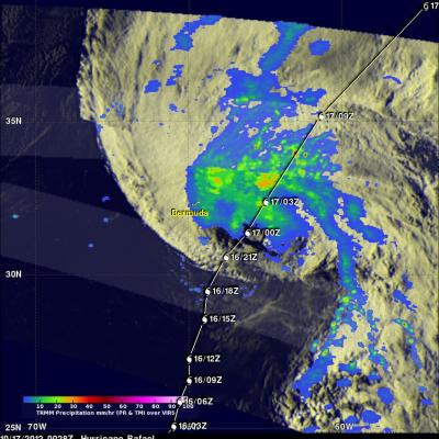
Tropical Storm Rafael Getting Stronger
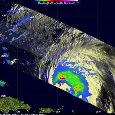
Tropical Storm Rafael Getting Stronger A low pressure center in the eastern Caribbean Sea became tropical storm Rafael on Friday October 12, 2012. The tropical storm wasn't very well organized until today but the National Hurricane Center (NHC) predicts that Rafael will become a hurricane this evening. The TRMM satellite saw most of Rafael on October 15, 2012 at 0218 UTC (10:18 PM EDT October 14) and collected data used in the rainfall analysis on the right.