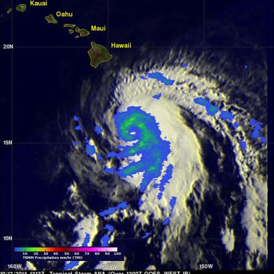
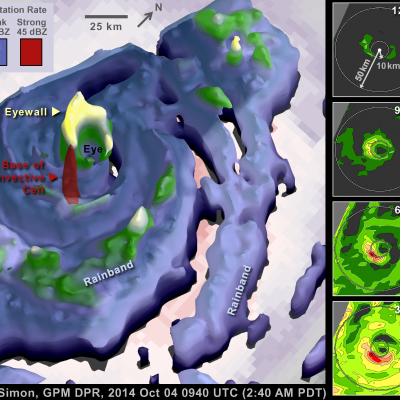
Hurricane Ana Bypasses But Soaks Hawaiian Islands
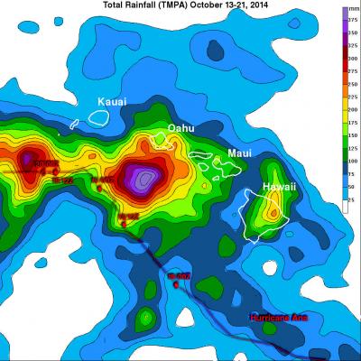
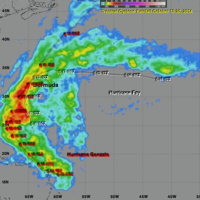
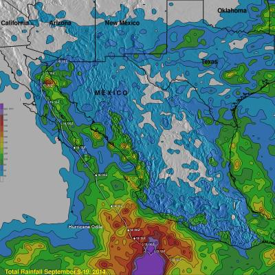
Fortunately for Hawaii hurricane Ana passed to the south of the islands. This meant that for the third time this year the Hawaiian Islands were spared destructive hurricane force winds. However, Ana caused occasionally heavy rain over much of the area and was responsible for flash floods on the the big island (Hawaii). This analysis shows estimated rainfall totals during the period when hurricane Ana formed on October 13, 2014 and moved west of the Hawaiian Islands on October 21, 2014. The TRMM-based, near-real time Multi-satellite Precipitation data (TMPA) analysis is used to monitor rainfall