GPM

Content which is affiliated solely with the Global Precipitation Measurement Mission.

GPM Used To Evaluate Tropical Storm Estelle

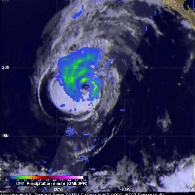
The GPM core observatory satellite traveled above tropical storm Estelle on July 19, 2016 at 1036 UTC. This pass showed that Estelle contained well organized convective bands that were producing precipitation within the storm. Precipitation within Estelle was analyzed using data collected by GPM's Microwave Imager (GMI) and Dual-Frequency Precipitation Radar (DPR) instruments. GPM's radar (DPR Ku band) data were used to perform a 3-D examination of the precipitation on the eastern side of tropical storm Estelle. Some rainfall was measured by DPR falling at a rate of over 65 mm (2.6 inches) per

Southern Hemisphere Tropical Cyclone Abela Viewed By GPM

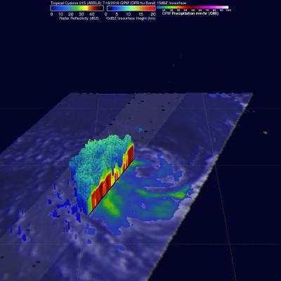
Tropical cyclone 01S (Abela) formed in the South Indian Ocean on July 16, 2016. Abela was the first tropical Cyclone to form in July over the South Indian Ocean since 2007 so it is a little unusual. The GPM core observatory satellite recently had two good views of Abela. GPM saw the newly formed tropical cyclone on Jul 16, 2016 at 2216 UTC. Precipitation data collected by GPM's Microwave Imager (GMI) and Dual-Frequency Precipitation Radar (DPR) instruments showed that ABELA contained a large area of rainfall on July 16, 2016. Then again on July 18, 2016 at 2206 the satellite passed above after

PPS Down for Temporary Maintenance 7/19/16

The PPS (Precipitation Processing System) will be down today, July 19, 2016 from 8:00am -14:00pm EDT (12:00 - 18:00 UTC). for scheduled maintenance. During this time all data transfers between PPS source and its consumer systems (GDAAC/DISC) as well as Science User services (FTP and STORM access) will be unavailable. You may contact PPS Operations at helpdesk@mail.pps.eosdis.nasa.gov You will be informed when PPS systems become available. We apologize for any inconvenience this may cause.

GPM Sees Tropical Depression SIX-E Forming

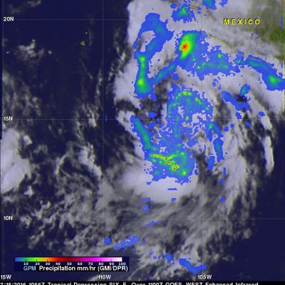
A large area of low pressure in the eastern Pacific Ocean was sufficiently organized and developed that the National Hurricane Center (NHC) designated it as tropical depression SIX-E on July 15, 2016 at 1500Z (9:00 AM MDT). With the development of tropical depression SIX-E there are currently three active tropical systems in the eastern Pacific Ocean. The GPM core observatory had a good view of forming tropical depression SIX-E when it flew over on July 15, 2016 at 1056 UTC (4:56 AM MDT). Precipitation data were calculated from data collected by GPM's Microwave Imager (GMI) and Dual-Frequency

Rainfall Measured By GPM In Weakening Tropical Storm Celia

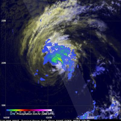
Celia was a powerful hurricane with winds of 85 kts (98 mph) a couple days ago but has recently been moving over cooler ocean waters that are contributing to a weakening trend. Hurricane Celia had weakened to a tropical storm with winds of about 45 kts (52 mph) when the GPM core observatory satellite flew over on July 14, 2016 at 0001 UTC. GPM found that convective storms were mainly located to the north and northeast of Celia's center of circulation. GPM's Microwave Imager (GMI) and Dual-Frequency Precipitation Radar (DPR) found that rain was falling at over 164 mm (6.4 inches) per hour

Forming Tropical Storm Darby Analyzed By GPM

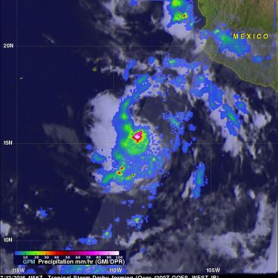
Tropical storm Darby became the fourth eastern Pacific Ocean tropical storm to form on July 12, 2016. Last year was an El Nino year and this year is transitioning to a La Nina year with cooler sea surface temperatures (SST) expanding across the eastern equatorial Pacific Ocean. Fewer tropical storms are normally expected to develop in the eastern Pacific Ocean during La Nina years but so far this year tropical cyclones are forming in the eastern Pacific Ocean at about the same pace as last year. The GPM core observatory satellite flew above tropical depression five (TD05E) on July 12, 2016 at

GPM Sees Hurricane Celia Twice

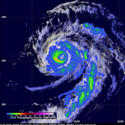
The GPM core observatory satellite twice flew almost directly above hurricane Celia in the eastern Pacific Ocean on July 12, 2016. The first time was on July 12, 2016 at 0011 UTC and the second view was on July 12, 2016 at 1326 UTC. With both passes GPM's Microwave Imager (GMI) clearly showed the location of rainfall around hurricane Celia's well defined eye. The hurricane had maintained intensity during this period with sustained maximum wind speeds estimated at 80 kts (92.8 mph). With the first pass GMI measured rain in the southwestern side of Celia's eye wall falling at a rate of close to

Nepartak Causes Havoc Then Dissipates Over China

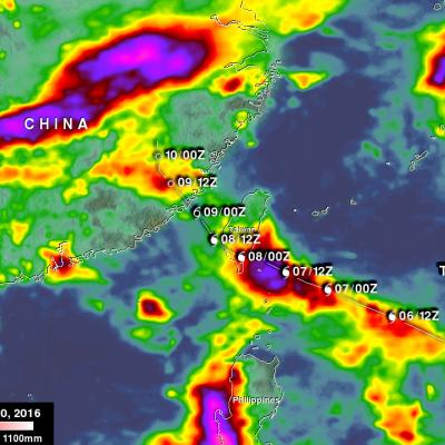
Nepartak was a powerful category four typhoon when it hit Taiwan last week but weakened to a tropical storm as it moved into the Taiwan Strait. Nepartak's winds and heavy rains caused severe problems when it moved ashore over southeastern China. Thousands of homes in China were destroyed by the storm. At least three deaths in Taiwan and six fatalities in China were attributed to Nepartak. Torrential rain caused flash flooding and mudslides in both Taiwan and China. NASA's Integrated Multi-satellitE Retrievals for GPM (IMERG) were again used to estimate the total amount of rain that Nepartak

Rapidly Intensifying Typhoon Examined By GPM

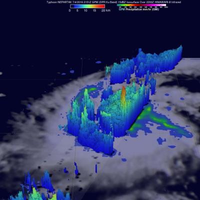
The first typhoon of 2016 called Nepartak developed in the western Pacific Ocean on July 3, 2016 south of Guam. Nepartak has moved to the west-northwest of Guam and has started to rapidly intensify. Warm water, low vertical wind shear and favorable outflow due an upper level trough are providing favorable environmental conditions for the typhoon. The GPM core observatory satellite flew above Nepartak on July 4, 2016 at 2151 UTC when the tropical cyclone was still classified as a tropical storm. GPM's Microwave Imager (GMI) and Dual-Frequency Precipitation Radar (DPR) data showed that Nepartak

IMERG Measures West Virginia's Deadly Flooding Rainfall

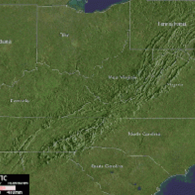
Since last Thursday over two dozen people have been reported killed and hundreds of homes have been destroyed by flooding in West Virginia. The governor of the state declared a federal disaster after the worst flooding in a century. The prevalence of rough terrain in West Virginia has amplified the effects of flooding rainfall. The National Weather Service predicted that thunderstorms were going to fall in the area again today. More flash flooding with streams again coming out of their banks has been predicted. NASA's Integrated Multi-satellitE Retrievals for GPM (IMERG) data were used in this