The Global Precipitation Measurement Mission (GPM)
GPM Mission Concept
The Global Precipitation Measurement (GPM) mission is an international network of satellites that provide next-generation global observations of rain and snow. Building upon the success of the Tropical Rainfall Measuring Mission (TRMM), the GPM concept centers on the deployment of a “Core Observatory” satellite carrying an advanced radar / radiometer system to measure precipitation from space and serve as a reference standard to unify precipitation measurements from a constellation of research and operational satellites. Through improved measurements of precipitation globally, the GPM mission is helping to advance our understanding of Earth's water and energy cycles, improve forecasting of extreme events that cause natural hazards and disasters, and extend current capabilities in using accurate and timely information of precipitation to directly benefit society. GPM, initiated by NASA and the Japan Aerospace Exploration Agency (JAXA) as a global successor to TRMM, comprises a consortium of international space agencies, including the Centre National d’Études Spatiales (CNES), the Indian Space Research Organization (ISRO), the National Oceanic and Atmospheric Administration (NOAA), the European Organization for the Exploitation of Meteorological Satellites (EUMETSAT), and others.
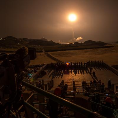
The GPM Core Observatory launched on February 27th, 2014 at 1:37pm EST from Tanegashima Space Center, Japan. Learn more about the launch.
Building upon TRMM’s Legacy
The Tropical Rainfall Measuring Mission (TRMM), launched by NASA and JAXA in 1997, used both active and passive microwave instruments to measure rainfall in the tropics. It also provided a foundation for merging rainfall information from other satellites. TRMM showed the importance of taking observations from a non-Sun-synchronous orbit at different times of the day, between observations by polar orbiting sensors at fixed times of the day, to improve near real-time monitoring of hurricanes and accurate estimates of rainfall accumulation over time. The GPM Core Observatory continues this sampling from a non-Sun-synchronous orbit and extends coverage to higher latitudes to provide a near global view of precipitation.
The GPM Core Observatory design is an extension of TRMM’s highly successful rain-sensing package, which focused primarily on heavy to moderate rain over tropical and subtropical oceans. Since light rain and falling snow account for significant fractions of precipitation occurrences in middle and high latitudes, a key advancement of GPM over TRMM is the extended capability to measure light rain (< 0.5 mm hr-1), solid precipitation and the microphysical properties of precipitating particles. This capability drives the designs of both the active and passive microwave instruments on GPM. The Core Observatory acts as a reference standard for the precipitation estimates acquired by the GPM constellation of sensors.
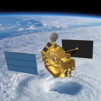
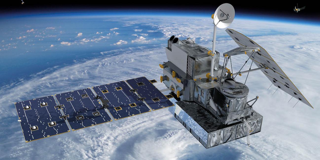
GPM Core Observatory Satellite
The GPM Core Observatory carries the first space-borne Ku/Ka-band Dual-frequency Precipitation Radar (DPR) and a multi-channel GPM Microwave Imager (GMI). The DPR instrument consists of a Ka-band precipitation radar (KaPR) operating at 35.5 GHz and a Ku-band precipitation radar (KuPR) operating at 13.6 GHz. DPR provides three-dimensional measurements of precipitation structure and characteristics. The DPR originally collected data over a swath of 78 and 152 miles (125 and 245km) for the Ka and Ku band radars respectively, but since May 2018 the swath now covers 152 miles (245 km) for both radars. Relative to the TRMM precipitation radar, the DPR is more sensitive to light rain rates and snowfall. In addition, simultaneous measurements by the overlapping of Ka/Ku-bands of the DPR can provide new information on particle drop size distributions over moderate precipitation intensities. In addition, by providing new microphysical measurements from the DPR to complement cloud and aerosol observations, GPM is expected to provide further insights into how precipitation processes may be affected by human activities.
The GMI instrument is a conically-scanning multi-channel microwave radiometer covering a swath of 550 miles (885 km) with thirteen channels ranging in frequency from 10 GHz to 183 GHz. The GMI uses a set of frequencies that have been optimized over the past two decades to retrieve heavy, moderate and light precipitation using the polarization difference at each channel as an indicator of the optical thickness and water content and precipitation systems.
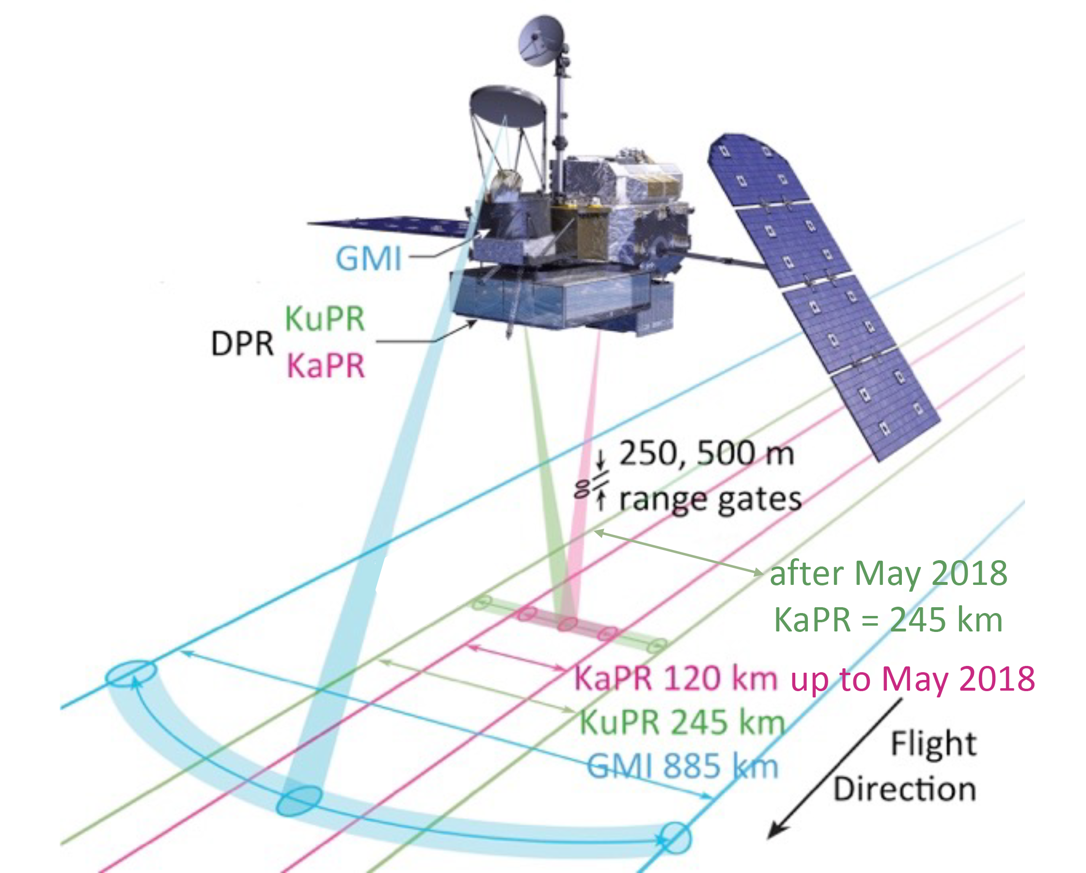
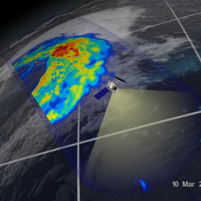
This diagram illustrates the dimensions covered by the GPM Core Observatory's Dual-frequency Precipitation Radar (DPR) and GPM Microwave Imager (GMI) instruments. NOTE: As of May 2018 the KaPR swath width is now also 245km. Last updated on March 20, 2024.
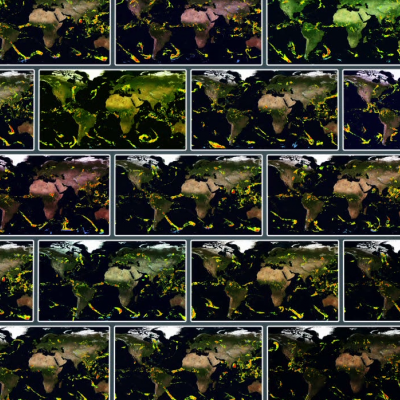
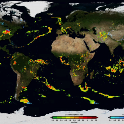
IMERG: Two Decades of Global Precipitation Data
NASA’s TRMM and GPM missions have collected rain and snowfall from space for more than 22 years (as of 2020), and for the first time in 2019 scientists can access PMM’s entire record as one unified data set. The Integrated Multi-satellitE Retrievals for GPM (IMERG) algorithm combines information from whatever constellation of satellites are operating around Earth at a given time to estimate precipitation over the majority of the Earth's surface. This algorithm is particularly valuable over the majority of the Earth's surface that lacks precipitation-measuring instruments on the ground. What is new in the latest Version 6 release of IMERG is that the algorithm can now fuse the early precipitation estimates collected in 2000-2014 during the operation of the TRMM satellite with more recent precipitation estimates collected during operation of the GPM satellite. The longer the record, the more valuable it is, as researchers and application developers will attest. By being able to compare and contrast past and present data, researchers are better informed to make climate and weather models more accurate, better understand normal and extreme rain and snowfall around the world, and strengthen applications for current and future disasters, disease monitoring, resource management, energy production and food security.
GPM Science and Applications
GPM provides global precipitation measurements with improved accuracy, coverage and dynamic range for studying precipitation characteristics. GPM also improves weather and precipitation forecasts through assimilation of instantaneous brightness temperatures and retrieved precipitation information. Relative to TRMM, the enhanced measurement and sampling capabilities of GPM offer many advanced science contributions and societal benefits:
- Improved knowledge of the Earth’s water cycle and its link to climate change
- New insights into storm structures and large-scale atmospheric processes
- New insights into precipitation microphysics
- Advanced understanding of climate sensitivity and feedback processes
- Extended capabilities in monitoring and predicting tropical cyclones and other extreme weather events
- Improved forecasting abilities for natural hazards, including floods, droughts and landslides.
- Enhanced numerical weather prediction skills
- Improved agricultural crop forecasting and monitoring of freshwater resources