Visualization of the GPM Core Observatory in space over a hurricane with constellation satellites in the background.

Mission Articles

GPM 10-in-10 Climate Banner
May 9, 2024, 8:00 p.m. ET Register Here Overview In this webinar we will explore Earth’s weather and climate through the lens of NASA. Learn the difference between weather and climate, why it’s challenging to accurately predict the weather, and explore different weather and climate models. Also, learn how NASA’s “Earth to Sky” program is engaging with interpreters across the U.S. to collaborate and share this and other information with the public. Speakers Dr. Marshall Shepherd Dr. J. Marshall Shepherd is a leading international weather-climate expert and is the Georgia Athletic Association
GPM 10-in-10 Earth's water banner
March 14, 2024, 8 p.m. ET Overview On March 22 we celebrate World Water Day! For the next in our GPM 10-in-10 webinar series, join NASA scientists to learn all about freshwater, Earth’s most precious resource. Find out how and why NASA keeps track of Earth's limited freshwater resources and discover how you can monitor precipitation yourself as a citizen scientist working with CoCoRaHS and the GLOBE Program . Guest speakers include John Bolten, Chris Kidd, Noah Newman, Marilé Colón Robles, and Dorian Janney. Resources Webinar 2 Recording Resource Packet About the Speakers John Bolten John is
GPM 10 Year Banner
Celebrate the Global Precipitation Measurement Mission's 10th Anniversary! The NASA / JAXA GPM Core Observatory satellite launched on Feb. 27, 2014 from Tanagashima Space Center in Japan, marking the start of the Global Precipitation Measurement mission . We will celebrate this ten-year anniversary throughout 2024 with special events and opportunities. We invite all of you to join us as we share how this international constellation has improved life around the globe. About GPM The GPM Mission & Core Observatory Satellite GPM Applications & Societal Benefits IMERG - A Global Map of Earth's Rain
GPM Core Observatory data of precipitation within Typhoon Mawar
Driven by powerful winds and intense rainfall, Typhoon Mawar emerged as a rapidly intensifying storm in the western Pacific Ocean. Originating from a tropical disturbance, the typhoon swiftly developed into a significant weather system, eventually making landfall on the U.S. territory of Guam on May 25, 2023, as a Category 4 typhoon. After hitting Guam, it further intensified into a Category 5 typhoon, making it one of the most powerful storms on record in the month of May. Download this video from the NASA Goddard Scientific Visualization Studio The combination of NASA’s IMERG precipitation
20 Years of IMERG - Resources
NASA Announces Long-term IMERG Satellite Record: A Near-Global 19-year Perspective on Rain and Snow NASA has just released its newest estimate of rain and snow covering the past 19 years. It's code name: Version 6 IMERG. NASA's IMERG -- the Integrated Multi-satellitE Retrievals for GPM -- combines information from whatever constellation of satellites are operating in Earth orbit at a given time, to estimate precipitation over the majority of the Earth's surface. This algorithm is particularly valuable over the majority of the Earth's surface that lacks precipitation-measuring instruments on...
Two Decades of Precipitation Measurement
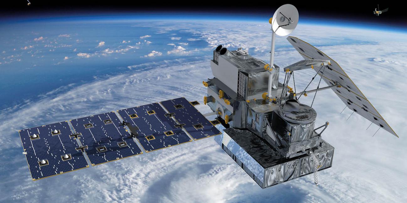
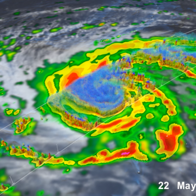
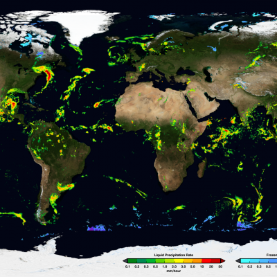
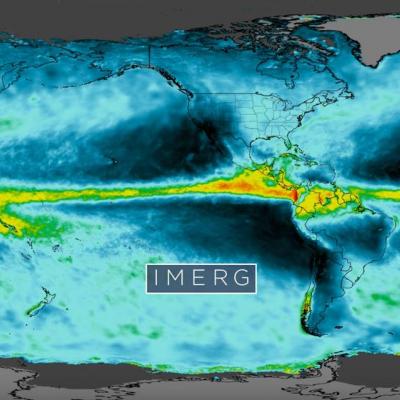
NASA’s Precipitation Measurement Missions (PMM) have collected rain and snowfall from space for nearly 20 years, and for the first time in 2019, scientists can access PMM’s entire record as one data set. PMM includes two missions – the Tropical Rainfall Measuring Mission (TRMM), which orbited Earth from 1997 to 2015, and its successor, the joint NASA-JAXA Global Precipitation Measurement mission (GPM), which has been collecting data since 2014. This year, however, the GPM project upgraded its data algorithms to calibrate and incorporate TRMM data into its release, giving researchers, modelers...
5 Years of Global Precipitation Measurement
Download this video in high resolution from the NASA Goddard Scientific Visualization Studio Five years ago, on Feb. 27, 2014, the Global Precipitation Measurement (GPM) Core Observatory, a joint satellite project by NASA and the Japan Aerospace Exploration Agency (JAXA), lifted off aboard a Japanese H-IIA rocket. Since then, the cutting-edge instruments on GPM have provided advanced measurements about the rain and snow particles within clouds, Earth’s precipitation patterns, extreme weather and myriad ways precipitation around the world affects society. Among the uses of GPM data are helping...
GPM Applications Logo
For the past 5 years GPM data has provided critical information to end-users to further our understanding of Earth's water cycle and to facilitate decision‐making at local and global scales. Building on the legacy of TRMM, the use of high‐quality precipitation data provided by GPM, with global coverage, has enabled new science research and data applications to benefit society across a diverse range of applications including water resource and ecological management, operational numerical weather prediction, disease prediction, and disaster modeling and response. Here are five highlights of the...
A New Multi-dimensional View of a Hurricane
Download in high resolution from the NASA Goddard Scientific Visualization Studio NASA researchers now can use a combination of satellite observations to re-create multi-dimensional pictures of hurricanes and other major storms in order to study complex atmospheric interactions. In this video, they applied those techniques to Hurricane Matthew. When it occurred in the fall of 2016, Matthew was the first Category 5 Atlantic hurricane in almost ten years. Its torrential rains and winds caused significant damage and loss of life as it coursed through the Caribbean and up along the southern U.S...
TRMM wins the 2016 Group Pecora Award
The William T. Pecora Award is presented annually to individuals or groups that make outstanding contributions toward understanding the Earth by means of remote sensing. The award is sponsored jointly by the Department of the Interior (DOI) and the National Aeronautics and Space Administration (NASA). The award was established in 1974 to honor the memory of Dr. William T. Pecora, former Director of the U.S. Geological Survey and Under Secretary, Department of the Interior. Dr. Pecora was a motivating force behind the establishment of a program for civil remote sensing of the Earth from space...

Hide Date