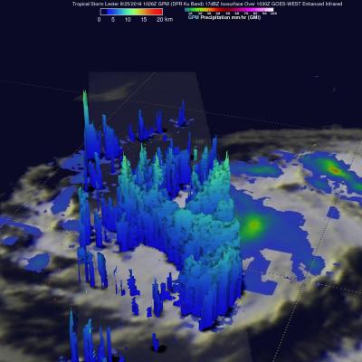
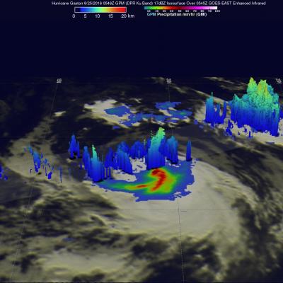
GPM Views Hurricane Gaston Eye Wall Replacement
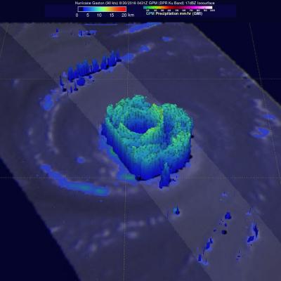
Hurricane Gaston was located in the central Atlantic Ocean west of Bermuda when the GPM core observatory satellite passed over on August 30, 2016 at 00:31 AM EDT (0431 UTC). Gaston was a category two on the Saffir-Simpson hurricane wind scale with maximum sustained winds of about 103.5 mph (90 kts). GPM happened to fly over as Gaston was undergoing an eye wall replacement. Intense rainfall was clearly shown by GPM in rain bands of both the inner and the outer replacement eye walls. Precipitation was calculated from data collected by GPM's Microwave Imager (GMI) and Dual-Frequency Precipitation