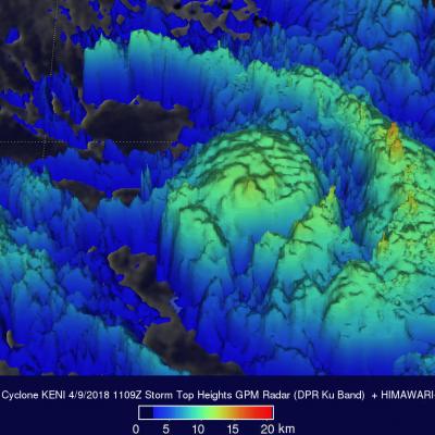
Tropical Cyclone Keni Drops Heavy Rain Over Fiji With A Direct Hit To Kadavu
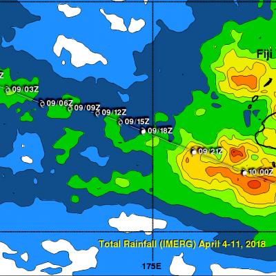
As expected, tropical cyclone KENI followed a track similar to tropical cyclone JOSIE and passed to the southwest of Fiji's main island of Viti Levu on April 10, 2018 (UTC). No casualties were reported with KENI even though it was a more powerful tropical cyclone than JOSIE. KENI was still intensifying when it passed directly over the island of Kadavu located just south of Viti Levu. Flash flooding was reported on Viti Levu and Kadavu. Maximum sustained winds of greater than 70 kts (81 mph) were responsible for widespread damage caused by the direct hit to Kadavu. KENI's peak winds of 85 kts