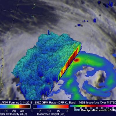
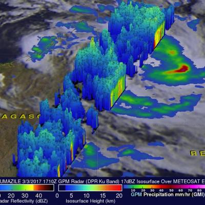
Tropical Cyclone Eliakim's Deadly Rainfall
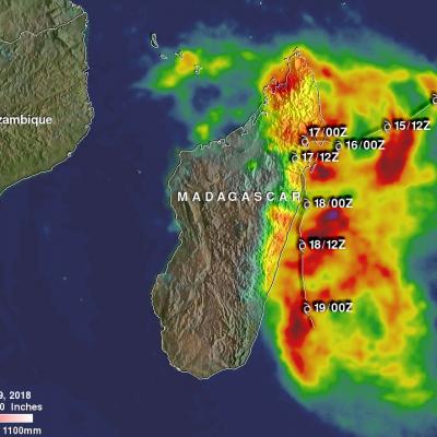
Tropical cyclone ELIAKIMS's heavy rainfall caused flooding and landslides over eastern Madagascar that resulted in at least seven deaths. ELIAKIM came less than two weeks after another tropical cyclone called Dumazile passed close to Madagascar. ELIAKIM maintained but didn't exceed tropical storm intensity as it battered Madagascar. ELIAKIM's slower movement as it passed over the island nation caused continuous heavy rainfall over northeastern Madagascar. Tropical cyclone ELIAKIM has now moved back into the Indian Ocean and is moving toward the southeast and away from Madagascar. This rainfall