Extreme Weather News

Jump to a Year

2024 | 2023 | 2022 | 2021 | 2020

2019 | 2018 | 2017 | 2016 | 2015

2014 | 2013 | 2012 | 2011 | 2010

2009 | 2008 | 2007 | 2006 | 2005

2004 | 2003 | 2002

GPM Views Rare Southern Hemisphere Tropical Cyclone

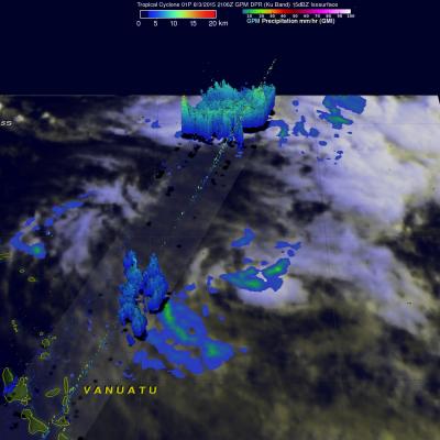
It is a little unusual to see a tropical cyclone forming in the southern Pacific Ocean this time of the year but tropical cyclone 01P formed northeast of Vanuatu recently. The GPM core observatory satellite saw Tropical Cyclone 01P on Monday August 3, 2015 at 2106Z (about 9:06 local time). GPM's Microwave Imager (GMI) found rain falling at a rate of over 30 mm (1.2 inches) per hour in a small area of showers near the center of the tropical cyclone. A 3-D view constructed from GPM's Dual-Frequency Precipitation Radar (DPR) instrument (Ku band) showed that some showers located between the

Super Typhoon Soudelor Threatens Taiwan And China

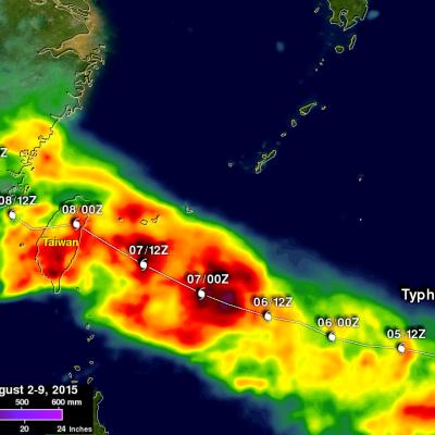
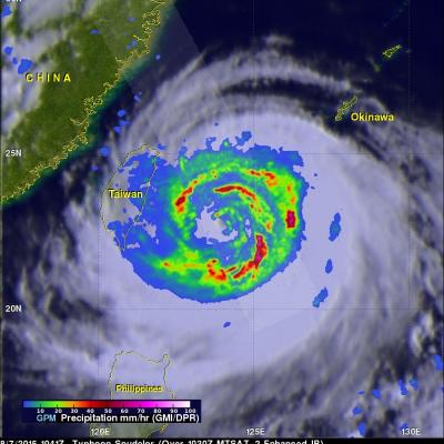
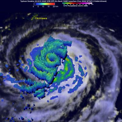
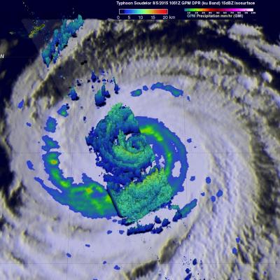
The GPM core observatory satellite flew almost directly over super typhoon Soudelor in the western Pacific Ocean on August 3, 2015 at 1104 UTC. At that time Super Typhoon Soudelor had winds of about 125kts (139 mph) and is predicted by the Joint Typhoon Warning Center (JTWC) to become even more powerful tomorrow while headed toward northern Taiwan. GPM's Microwave Imager (GMI) had a very good view of heavy rainfall associated with Soudelor. GMI showed that the super typhoon had rain falling at a rate of over 58 mm (2.3 inches) per hour in the southern side of Soudelor's well defined eye. Radar

Weakening Hurricane Guillermo Nears Hawaiian Islands

Hurricane Guillermo was a category one hurricane with wind speeds of about 75 kts (86 mph) when the GPM core observatory satellite flew over on Sunday August 2, 2015 at 1901 UTC. Rainfall was measured by GPM's Microwave Imager (GMI) and Dual-Frequency Precipitation Radar (DPR) instruments falling at a rate of over 61 mm (2.4 inches) per hour northeast of Guillermo's eye. GPM's DPR found rain falling at a rate of over 91 mm (3.6 inches) per hour in a feeder band spiraling into Guillermo from the southeast. GPM radar reflectivity data (Ku band) were used to show a 3-D cross section through the

Hurricane Guillermo Heads Toward Hawaii

On July 29, 2015 tropical depression Nine-E formed in the eastern Pacific Ocean well southwest of the southern tip of Baja California. The tropical depression was in an area of warm ocean water which helped the tropical cyclone blossom into tropical storm Guillermo early on July 30, 2015. Guillermo is a hurricane today and is headed over the open waters of the Pacific Ocean toward the west-northwest. In about a week Guillermo may affect the Hawaiian Islands as a tropical storm. On July 31, 2015 at 0556 UTC Guillermo was about 319 km (~590 Nautical Miles) east-southeast of Hilo, Hawaii when the