Tropical Storm Chantal
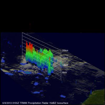
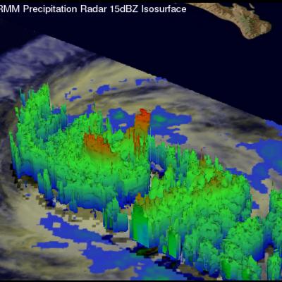
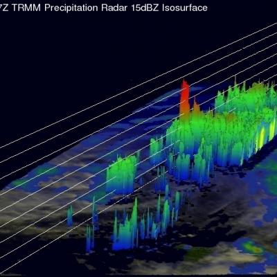
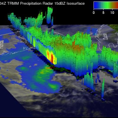
The TRMM satellite had a very good view of forming tropical storm Chantal, east-southeast of the Lesser Antilles, on July 8, 0155 UTC. TRMM Microwave (TMI) and Precipitation Radar (PR) rainfall data are shown overlaid on an enhanced infrared image from the Visible and InfraRed Scanner (VIRS). This analysis shows that the most intense rain was falling at a rate of over 115.5 mm/hr (~4.5 inches) near Chantal's center of circulation. This simulated 3-D view, looking from the west, uses TRMM's Precipitation Radar (PR) instrument to show the very powerful storms near Chantal's center of circulation