Central America

IMERG Rainfall Rates and MUR Sea Surface Temperatures from the 2020 Hurricane Season
Forecasters predicted an above-normal hurricane season for 2020. They weren’t wrong. As the 2020 Atlantic hurricane season smashed records with an unprecedented 30 named storms , NASA’s Earth Applied Sciences Disasters Program stood up to the challenge. The Disasters Program helps leaders and responders at national, regional, and local levels leverage NASA’s technology and expertise to assess, predict, and understand disasters' impacts. The Disasters Program targets a wide range of hazards and disasters , and while NASA is not an operational response agency, the agency offers access to unique
IMERG Rainfall Totals from Eta & Iota, November 1 - 18
The record-breaking 2020 Atlantic hurricane season, aided by the ongoing La Niña, is officially the most active Atlantic hurricane season on record, surpassing the 2005 season in the total number of named storms with 30 to date. Incredibly, the latest storm Iota wasn’t just another named storm, but a powerful Category 5 hurricane and the strongest storm of the season. It was also only the 2 nd Category 5 storm to occur in the month of November on record, the other being in 1932. The warm waters of the Caribbean continue to serve as a breeding ground for late-season storms this season. Iota
Hurricane Eta IMERG Screenshot
The extremely active 2020 Atlantic hurricane season, aided by the ongoing La Niña, continues on. After Hurricane Zeta made landfall along the northern part of the Gulf Coast, yet another hurricane has arisen - Hurricane Eta, the strongest of the season. Like Zeta, Eta also formed in the Caribbean, where sea surface temperatures are still running quite warm at around 29° C, almost a full degree above average and well above the typical 26° C needed for tropical cyclone development. But while Zeta turned north into the Gulf of Mexico, Eta moved westward where it delivered powerful winds and
GPM Eta Screenshot
The Global Precipitation Measurement (GPM) Core Observatory satellite flew over Hurricane Eta at 11:41 p.m. CT on Tuesday, Nov. 3 (0541 UTC Wednesday, Nov. 4). GPM observed the storm’s rainfall with its two unique science instruments: the GPM Microwave Imager ( GMI ) and Dual-frequency Precipitation Radar ( DPR ). As the visualization shows, the instruments observed a large swath of heavy precipitation extending to the north and east of the hurricane’s center, which matched earlier forecasts that called for particularly heavy rainfall across the storm’s path. These two- and three-dimensional

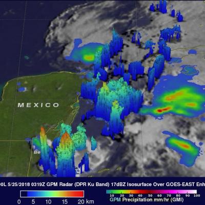
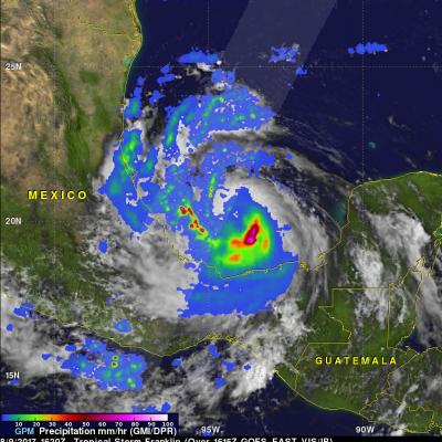
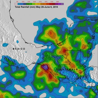
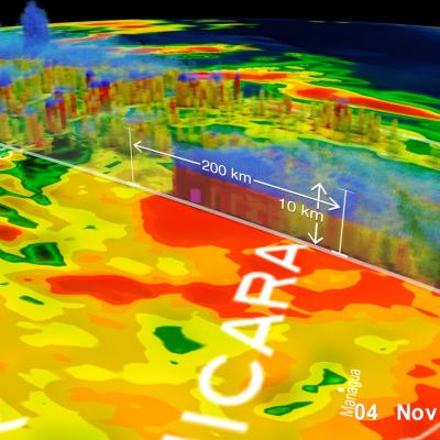
Cristobal Drenches Central America

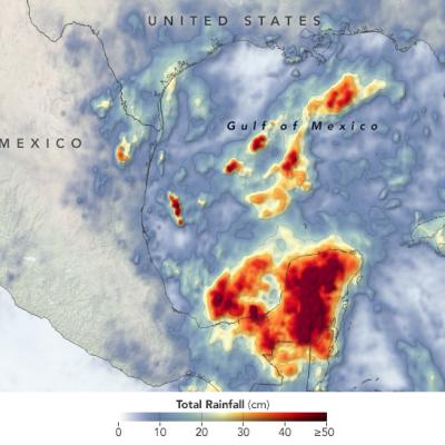
The 2020 Atlantic hurricane season is off to a busy start. By the first week of June, Tropical Storm Arthur had already brushed North Carolina , Tropical Storm Bertha had drenched South Carolina , and the third named storm of the year— Cristobal—was dropping torrential rain on the Yucatán Peninsula. The storm first developed in the Pacific in late May as Tropical Storm Amanda, spinning off the southern end of a seasonal low-pressure pattern called the Central American Gyre . After making landfall in Guatemala and causing deadly floods in El Salvador , Amanda weakened and became less organized

GPM Examines Forming Subtropical Storm Alberto

At 10:00 AM CDT today the National Hurricane Center (NHC) upgraded low pressure center (90L) to Subtropical Storm Alberto. Alberto moved over the waters of the northwestern Caribbean Sea. Alberto is expected to bring heavy rainfall and flash flooding to the northeastern Yucatan, western Cuba and Florida over the Memorial Day weekend. The GPM core observatory satellite passed above the Yucatan Peninsula on May 24, 2018 a 11:19 PM EDT (May 25, 2018 at 0319 UTC). With this pass GPM saw areas of heavy precipitation within the western Caribbean and in the Gulf Of Mexico west of Cuba. GPM's Dual

GPM Sees Franklin Becoming A Hurricane

As expected, tropical storm Franklin intensified and was upgraded to hurricane Franklin in the afternoon of August 9, 2017. Franklin made landfall on the coast of eastern Mexico early this morning as a category 1 hurricane with winds of over 86 mph (75 kts). Heavy rainfall, flash floods and mudslides are expected as Franklin moves inland and weakens. The remnants of Franklin may survive the transit over Mexico's rough terrain and revive after moving into the eastern Pacific Ocean. The GPM core observatory satellite saw tropical storm Franklin with winds of about 69 mph (60 kts) as it was

GPM Sees Intensifying Tropical Storm Franklin

The GPM core observatory satellite had an informative pass over Tropical storm Franklin on August 9, 2017 at 0302 UTC. The intensifying tropical storm had moved from Mexico's Yucatan Peninsula into the southwestern Gulf Of Mexico's Bay of Campeche. GPM's Microwave Imager (GMI) and Dual-Frequency Precipitation Radar (DPR) data showed that Franklin contained a few heavy bands of convective rainfall. GPM's DPR found rain falling at a rate of over rain 2.4 inches (62 mm) per hour in bands of intense storms moving around the southwestern side of the storm. This 3-D view of tropical storm Franklin

Tropical Storm Otto Develops, Threatens Central America

Tropical storm Otto formed in the southwestern Caribbean north of Panama on November 21, 2016. The GPM core observatory satellite had an excellent daytime view of the newly formed tropical storm on November 21, 2016 at 1906 UTC (2:06 PM EST). Otto had wind speeds estimated at 45 kts (52 mph) at that time. GPM satellite rainfall data are shown overlaid on a visible and infrared image captured by the GOES-EAST satellite at 1915 UTC (2:15 PM EST). GPM's Microwave Imager (GMI) and Dual-Frequency Precipitation Radar (DPR) revealed that the newly formed tropical storm had deep convective bursts in

Heavy Rainfall For Mexico & Central America

The movement of tropical storm Boris into southern Mexico and a nearly stationary low pressure system in the southern Gulf Of Mexico has been causing heavy rainfall in that area. The TRMM-based, near-real time Multi-satellite Precipitation Analysis (TMPA) at the NASA Goddard Space Flight Center monitors rainfall over the global Tropics. TMPA rainfall totals are shown here for the period May 29 to June 6, 2014. The highest rainfall totals of over 535 mm were analyzed where tropical storm Boris came ashore in southern Mexico. The slow moving low pressure center in the Bay Of Campeche is