Powerful Hurricane Ophelia Seen Heading Toward Ireland
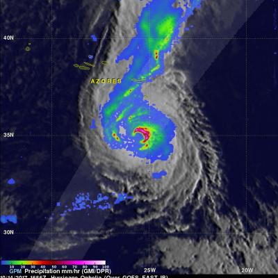
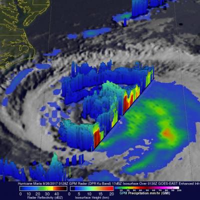
The GPM core observatory passed directly above hurricane Ophelia on October 14, 2017 at 1656 UTC. Ophelia was a powerful category three on the Saffir-Simpson hurricane wind scale with sustained winds of close to 115 mph (100 kts). GPM's Microwave Imager (GMI) and Dual-Frequency Precipitation Radar (DPR) instruments collected data showing the locations of extremely heavy rainfall with the hurricane. GPM's radar unveiled intense downpours in the northeastern side of Ophelia's eye that were dropping rain at the extreme rate of over 8.4 inches (213 mm) per hour. Other intense feeder bands with