Ophelia Becomes a Hurricane
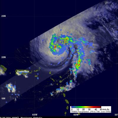
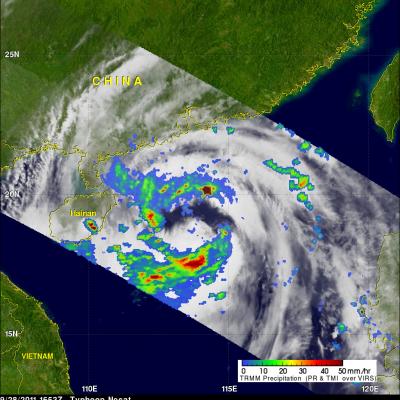
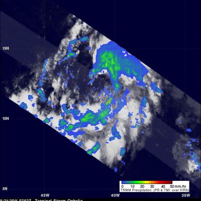
The TRMM satellite saw tropical storm Ophelia on 29 September 2011 at 2008 UTC ( 4:08 PM EDT) shortly before the storm was upgraded to a hurricane by the National Hurricane Center (NHC). An analysis of rainfall from TRMM's Microwave Imager (TMI) and Precipitation Radar (PR) data shows that Ophelia was developing an eye with powerful thunderstorms located in the northwestern side of the forming eye wall. On Friday 30 October 2011 Ophelia further intensified to become a powerful category three hurricane on the Saffir-Simpson scale with winds of 100kts (~115 mph). The NHC has predicted that this