Landslides
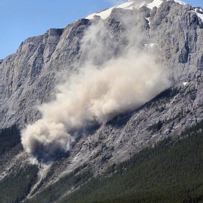
Landslides are a widespread and often underestimated natural hazard, causing thousands of deaths and significant economic damage each year. They routinely block roads, destroy infrastructure, and disrupt communities. Intense or prolonged rainfall is the most common landslide trigger, but earthquakes and human activities can also cause them.
Using satellite data, models, and citizen science reports, NASA researchers have developed a collection of tools and datasets to improve our understanding of landslides and help communities around the world monitor, predict, and respond to these destructive events.
NASA Landslides Projects
- Semi-Automatic Landslide Detection (SALaD)
- Landslide density heatmaps
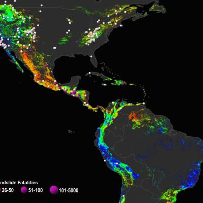
- Global Landslide Catalog (GLC)
- Landslide Change Characterization Experiment (LACCE)
- Landslide Hazard Assessment for Situational Awareness (LHASA)
- LHASA-Mekong
- Landslide Hazard Awareness for Karnali (LHASKarnali)
- A global landslide susceptibility map
NASA Landslides Data
- Global Landslide Catalog
- Landslide Reporter Catalog
- NASA rapid-response landslide inventories
- High Mountain Asia Multitemporal Landslide Inventories
- Global Landslide Nowcast
- High Mountain Asia Daily 5km Landslide Hazard Indicator
- Global landslide susceptibility map
More Info
- Aakash Ahamed
- Alexander Handwerger
- Amanda Rumsey
- Chelsea Dandridge
- Dalia Kirschbaum
- Daniel Wright
- David Bekaert
- Eli Orland
- Elise Monsieurs
- Eric Anderson
- Eric Fielding
- Hakan Tanyas
- Jack Simmons
- Jessica Fayne
- Jessica Sutton
- Jordan Borak
- Jordan Psaltakis
- Justin Roberts-Pierel
- Kaytan Kelkar
- Michael Jasinski
- Nishan Biswas
- Patrice Cappelaere
- Pukar Amatya
- Rachel (Soobitsky) Vershel
- Robert Adler
- Robert Emberson
- Sana Khan
- Soni Yatheendradas
- Thomas Stanley
- Tim Lahmers
- Yang Hong
- Yaping Zhou
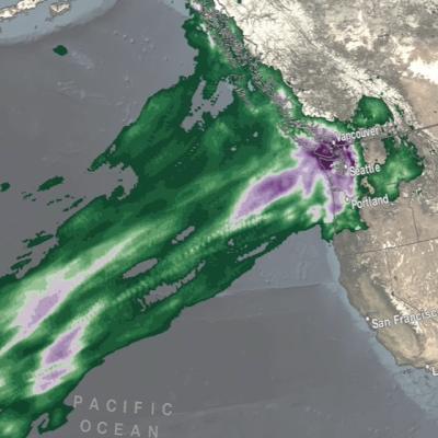
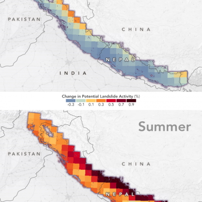
The global peak in landslide activity occurs during summer in the northern hemisphere. This cycle is driven by intense rainfall, especially the Asian summer monsoon. However, many locations have peaks in landslide activity at other times of year. This cycle can be seen both in the Global Landslide Catalog (GLC) and in historical simulations from the Landslide Hazard Assessment for Situational Awareness (LHASA) model.
Kirschbaum D. B., T. Stanley and Y. Zhou. 2015. "Spatial and temporal analysis of a global landslide catalog." Geomorphology 249 (Geohazard Databases): 4-15 10.1016/j.geomorph.2015.03.016
Kirschbaum D. and T. Stanley. 2018. "Satellite-Based Assessment of Rainfall-Triggered Landslide Hazard for Situational Awareness." Earth's Future 6 (3): 505-523 10.1002/2017ef000715
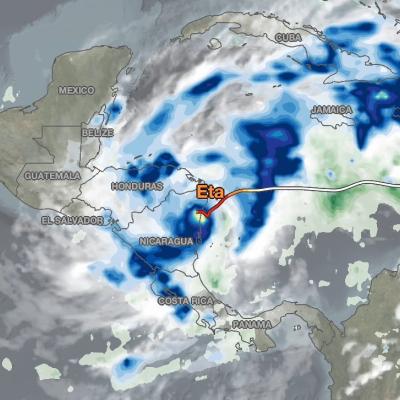
In addition to an annual cycle, landslides are also influenced by the El Niño Southern Oscillation (ENSO).
Emberson R., D. Kirschbaum and T. Stanley. 2021. "Global connections between El Nino and landslide impacts." Nature Communications 12 (1): 2262 10.1038/s41467-021-22398-4
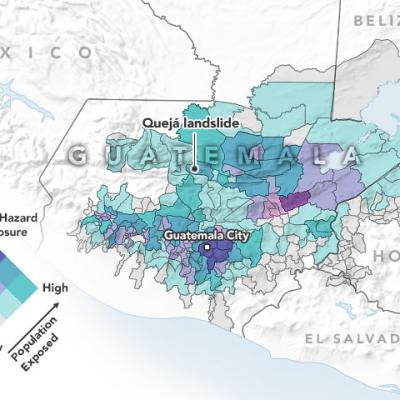
Landslides cause billions of dollars in infrastructural damage and thousands of deaths every year. NASA works to better understand this hazard because knowledge can guide decision makers to reduce the risks we all face from future landslides. Earth-orbiting satellites offer a unique view on landslides, covering inaccessible locations and visiting the whole world on a regular schedule.
The Cooperative Open Online Landslide Repository, or COOLR, is an open platform where scientists and volunteers can share information about landslides.
Do your part and Report a Landslide!