


Thumbnail
a | b | c | d | e | f | g | h | i | j | k | l | m | n | o | p | q | r | s | t | u | v | w | x | y | z Click one of the letters above to advance the page to terms beginning with that letter. A active sensor search for term A remote-sensing sys­tem (e.g., an instrument) that transmits its own radiant energy to detect an object or area for observation and receives the reflected or transmitted energy. Radar is an example of an active system. Compare with passive sensor. algorithm search for term A self-contained step-by-step set of operations to be performed. Scientists use mathematical algorithms
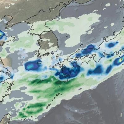
IMERG rainfall totals from Japan, June 29 - July 5, 2020
This animation shows NASA IMERG rain rates (blue shading) and accumulations (green shading) near Kyushu island, in the southwest of Japan from June 29 - July 5, 2020. Devastating floods and landslides swept through parts of Kyushu on July 4, 2020, resulting in over 40 deaths and orders for hundreds of thousands of people to evacuate their homes according to media reports. Download video (right-click -> Save As) The rains that triggered the flooding occurred in the context of the Meiyu-Baiu rainy season, which arrives in east Asia every year from June to mid-July. “Meiyu” and “Baiu” are the

TKIO Annoucement - PPS is Announcing a New tkio-3.9 Release

PPS has created a new PPS/GPM Science Algorithm Toolkit (TKIO) package which includes all the latest production formats. Those wishing to access new production data products listed below using C and Fortran interfaces may wish to download this TKIO package. Those using development TKIO versions that include the newer products do not need this public distribution, it is optional. This 3.97 TKIO includes all production formats including the recent additions of the V06X radar products and 3B42/3 in HDF5. The direct link is ftp://gpmweb2.pps.eosdis.nasa.gov/pub/PPStoolkit/GPM/tkio-3.97/tkio-3.97
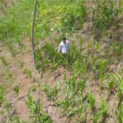
Farmer in a field in El Salvador
To reduce risks from natural disasters and build climate resilience, decision makers are using NASA Earth observations to develop index-based insurance products and protect low-income customers in Central America, especially in the region known as the Dry Corridor.

PPS is Releasing New METOPC MHS GPM L1C and GPROF METOPC MHS GPM Level 2 and Level 3 Data and Climatology Products

Commencing today, Wednesday January 29, 2020, PPS is producing and releasing new satellite METOPC MHS GPM Level 1C and GPROF METOPC MHS GPM Level 2 and Level 3 data and Climatology Products V05. These new products will have the starting date of December 11, 2019. GPROF METOPC MHS GPM Level 2 and Level 3 Climatology products will be produced once the ERA5 input data is received for December 2019. See the tables below for pertinent details. List of data types, product versions and start dates +---------------------+----------------+---------------------+ | DataType | ProductVersion | StartDate |