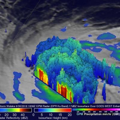
GPM's GMI Measures Weakening Kong-Rey's Rainfall
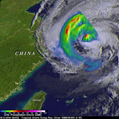
The GPM core observatory passed above tropical storm Kong-Rey on October 5, 2018 at 0846 UTC. Kong-Rey was a powerful category five typhoon just a few days ago but increased vertical wind shear and cooler sea surface temperatures have caused the tropical cyclone to weaken dramatically. Tropical storm Kong-Rey had maximum sustained winds of about 55 kts (63 mph) when it was scanned by the satellite. GPM's Microwave Imager (GMI) data were used to gauge the intensity of precipitation around Kong-Rey's center of circulation. Energy observed through clouds by GMI's microwave channels was used to