Extreme Weather News

Jump to a Year

2024 | 2023 | 2022 | 2021 | 2020

2019 | 2018 | 2017 | 2016 | 2015

2014 | 2013 | 2012 | 2011 | 2010

2009 | 2008 | 2007 | 2006 | 2005

2004 | 2003 | 2002

GPM Views Hurricane Lane Approaching Hawaii

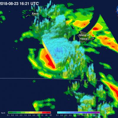
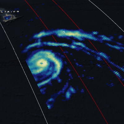
View Fullscreen in STORM Event Viewer Direct strikes on Hawaii by tropical cyclones are relatively rare, but Hurricane Lane is poised to buck that trend if the models are to be believed. At the time of this overflight, Lane had maximum sustained winds of 130 knots and featured a symmetrical eye in the GMI data with intense precipitation rates on both east and west sides of the tight circulation. Its impacts are likely to start with flooding, especially on the island of Hawaii. High surf and strong winds will also have an impact, although the locations of maximum intensity will be determined by

GPM Views "Truck-Tire" Eyewall of Typhoon Soulik

View Fullscreen in STORM Event Viewer Avoiding Kyushu, Typhoon Soulik instead barrelled toward the Northern Ryukyu islands, with the 'truck-tire' eyewall impacting Amami (in the south) and Yakushima (in the north) Islands in this overflight. It featured winds approaching 100 knots as it moved northwestward. Soulik is expected to recurve toward the western coast of Korea, where it is likely to have devastating impacts to the majority of the peninsula depending on its ability to maintain intensity.

Powerful Hurricane Lane Probed By GPM Satellite

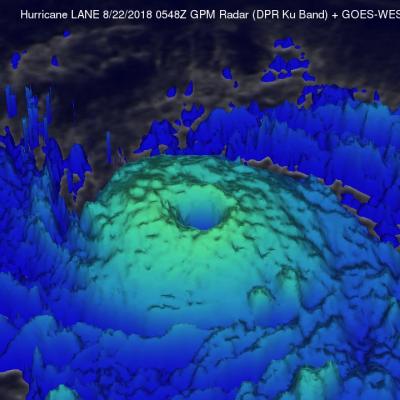
Hurricane LANE had moved westward into the central Pacific Ocean far southeast of the Hawaiian islands when the GPM core observatory satellite passed above on August 19, 2018 at 1643 UTC. LANE had intensified and had maximum sustained winds reaching about 105 kts (~ 121 mph) at that time. This made it a category three on the Saffir-Simpson hurricane wind scale. The GPM satellite's Microwave Imager (GMI) and Dual-Frequency Precipitation Radar (DPR) instruments provided highly accurate information about precipitation within the hurricane. GPM's GMI revealed rainfall coverage and GPM's radar (DPR

Intensifying Hurricane Lane Examined by GPM Satellite

View fullscreen in STORM Event Viewer Heavy rainfall and towering cloud heights were the findings when Hurricane Lane was scanned by the Global Precipitation Measurement mission or GPM core observatory satellite on Aug. 17. Lane strengthened to a Category 2 hurricane on the Saffir-Simpson Hurricane Wind Scale. GPM passed above Lane in the Eastern Pacific Ocean on Aug. 17, 2018, at 1:26 a.m. EDT (0526 UTC). Lane was intensifying and data collected by GPM's Microwave Imager (GMI) and Dual-Frequency Precipitation Radar (DPR) instruments revealed the location of its forming eye wall. Very heavy

Subtropical Depression Five Observed By GPM

Subtropical Depression FIVE formed in the central Atlantic Ocean early today. The National Hurricane Center (NHC) classified it as subtropical. It is moving over warm ocean waters and has low vertical wind shear aloft so the system is predicted to slightly intensify. The GPM core observatory satellite passed above the western side of newly formed Subtropical Depression FIVE on August 15, 2018 at 1046 UTC. The GPM's Microwave Imager (GMI) and Dual-Frequency Precipitation Radar (DPR) instruments revealed that most of the rainfall within the subtropical depression was outside the middle of the