Tropical Storm Ampil's Rainfall Evaluated With GPM Satellite Data
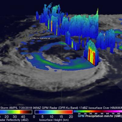
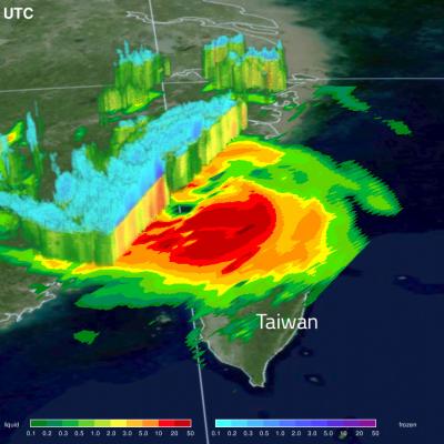
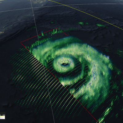
Tropical storm AMPIL was moving toward the northwest with winds of about 50 kts (57.5 mph) when the GPM core observatory satellite flew above on July 20, 2018 at 0656 UTC. Data received by the satellite's Microwave Imager (GMI) and Dual-Frequency Precipitation Radar (DPR) instruments were used in this analysis of AMPIL's precipitation. GMI and DPR showed that the northern side of the tropical storm was nearly dry and that rain bands in that area were producing only light to moderate rainfall. Moderate to heavy precipitation was found by GPM in a rain band wrapping around the southern side of