Extreme Weather News

Jump to a Year

2024 | 2023 | 2022 | 2021 | 2020

2019 | 2018 | 2017 | 2016 | 2015

2014 | 2013 | 2012 | 2011 | 2010

2009 | 2008 | 2007 | 2006 | 2005

2004 | 2003 | 2002

GPM Observes Dangerous Super Typhoon Heading Toward The Philippines

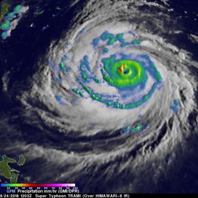
The GPM core observatory satellite has recently provided very useful information about super typhoon MANGKHUT in the western Pacific Ocean. A few days ago MANGHUT battered the Marianas Islands. MANGKHUT's destructive winds pounded the island of GUAM causing power outages and it's extremely heavy rainfall caused flash floods. The GPM core observatory satellite passed over super typhoon MANGKHUT on September 11, 2018 at 0407 UTC when it was west of GUAM. GPM's Microwave Imager (GMI) and Dual-Frequency Precipitation Radar (DPR) collected data showing that MANGKHUT was a large and very well

GPM Probes Tropical Storm Isaac

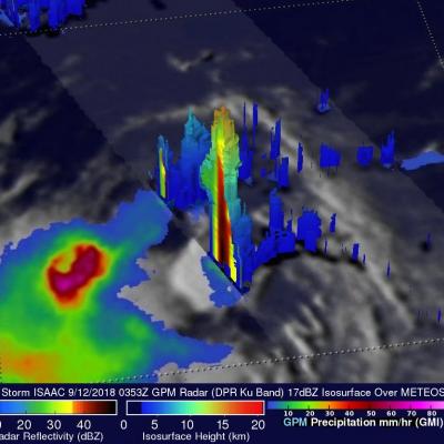
Hurricane Florence, tropical storm ISAAC and hurricane Helene are currently active in the Atlantic Ocean. Tropical storm ISAAC is the next tropical cyclone to affect the western Atlantic. It is moving westward toward the Leeward and Windward Islands. The National Hurricane Center (NHC) predicts that ISAAC will pass through the Leeward and Windward Islands and move into the Caribbean Sea over the next few days. The NHC predicts that ISAAC will weaken as it encounters moderate vertical shear and nearby dry air. The GPM core observatory satellite had an excellent view of tropical storm ISAAC on
GPM Flies Over Tropical Cyclone Florence
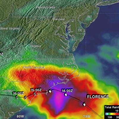
Download in High Resolution from the NASA Goddard Scientific Visualization Studio GPM passed over Tropical Storm Florence on September 7, 2018. As the camera moves in on the storm, DPR's volumetric view of the storm is revealed. A slicing plane moves across the volume to display precipitation rates throughout the storm. Shades of green to red represent liquid precipitation. Frozen precipitation is shown in cyan and purple. NASA's Global Precipitation Measurement mission or GPM core observatory satellite flew over Tropical Storm Florence on September 7, 2018. At that time, the storm was...

GPM Views Super Typhoon Mangkhut Moving Towards the Coast of China

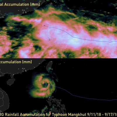
View Fullscreen in STORM Event Viewer A day after rolling through the southern Mariana Islands, causing wind and water damage to Guam and other nearby islands, Mangkhut has intensified into a Category 4 Super Typhoon with winds of 135 knots. With favorable conditions and the warm waters of the Philippine Sea, it is expected to maintain much of this intensity as it continues to track west-northwestward. Currently models anticipate Mangkhut to pass between the Phillipines and Taiwan, weakening slightly due to interaction with the two islands, before continuing toward the Southeastern Chinese

GPM Sees Heavy Rain In Menacing Hurricane Florence

Last Friday Florence was a sheared tropical storm but on Saturday vertical shear lessened and Florence started to get better organized. Today hurricane Florence is rapidly strengthening. The National Hurricane Center (NHC) predicts that Florence will be a major hurricane with maximum sustained winds peaking at 130 kts (~150 mph) on Wednesday when it is over the open Atlantic well southwest of Bermuda. The NHC predicts that Florence's winds will decrease slightly to 125 kts (144 mph) as the hurricane threatens the southeastern United States on Thursday September 13, 2018. OVERPASS 9/9/18: View