Extreme Weather News

Jump to a Year

2024 | 2023 | 2022 | 2021 | 2020

2019 | 2018 | 2017 | 2016 | 2015

2014 | 2013 | 2012 | 2011 | 2010

2009 | 2008 | 2007 | 2006 | 2005

2004 | 2003 | 2002

Tropical Storm Gordon's Rainfall Measured With IMERG

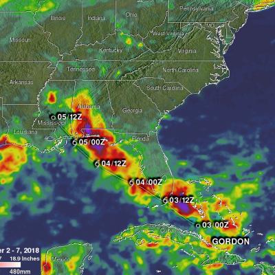
Tropical Storm Gordon became the seventh named system of the 2018 Atlantic hurricane season on Monday September 3, 2018. GORDON became more intense as it moved through the eastern Gulf Of Mexico but didn't quite make it to hurricane force before landfall. GORDON was a strong tropical storm with winds of about 70 mph (~ 61 kts) when it hit southeastern Mississippi on September 5, 2018. GORDON continued to produce rainfall as it moved inland. Weakening GORDON spawned a tornado near Picayune, Mississippi on Thursday September 6, 2018. Today, tropical depression GORDON is still responsible for

GPM IMERG Adds Up Heavy Rains from Typhoon Jebi

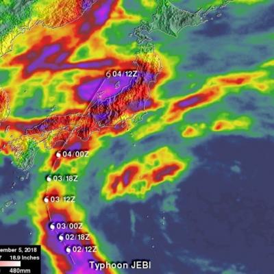
Typhoon Jebi brought flooding to Japan and NASA’s IMERG estimated rainfall over the country and the surrounding region for a one-week period. The above image shows accumulated IMERG rainfall estimates over Japan and the surrounding region for the 1-week period from August 29 to Sept. 5, 2018 show rainfall amounts on the order of 100 mm (~4 inches, shown in red) or more covering much of the main island of Honshu and Shikoku in the south. Much of the band of rain oriented east-west across central Japan was due to a frontal system that brought rain to the area before Jebi made landfall. Super

GPM Sees Hurricane Florence Swirling In The Central Atlantic

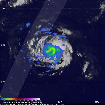
Hurricane FLORENCE became more powerful over the past few days while moving through the central Atlantic Ocean. Wind speeds increased from tropical storm force to hurricane force on Tuesday. FLORENCE's maximum sustained winds were about 85 kts (98 mph) early today making it a category two hurricane on the Saffir-Simpson Hurricane wind scale. Hurricane FLORENCE is being steered toward the northwest by the Atlantic subtropical ridge. Early next week the National Hurricane Center (NHC) predicts that hurricane FLORENCE will have moved to a location southeast of Bermuda. The GPM core observatory

GPM Views Super Typhoon Jebi Twice

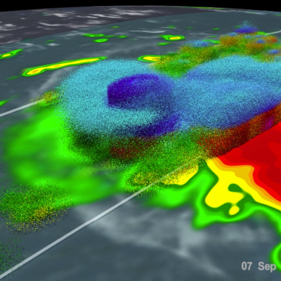
UPDATE 8/31/18 View Fullscreen in STORM Event Viewer Having peaked in intensity, Typhoon Jebi is a Category 5 Super Typhoon with maximum winds estimated around 142 knots. It is beginning an eyewall replacement cycle with a gap between the outer and inner eyewalls appearing somewhat in the DPR. The storm's strength is expected to fluctuate but remain well above Category 3 for the next two days before it turns northward toward Japan. It will likely have widespread impacts on Southern Honshu in around 4 days time, an area that has already struggled with rainfall, typhoons, and intense heat this

GPM Sees Tropical Cyclone Jebi Threaten Japan

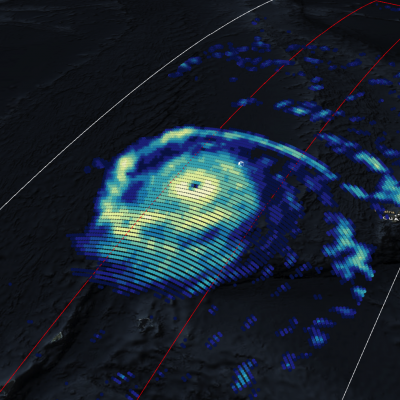
Japan has been afflicted by several tropical cyclones and other extreme weather this summer. The Joint Typhoon Warning Center (JTWC) predicts that yet another typhoon called JEBI will be approaching the main islands of Japan early next week. Warm ocean temperatures and low vertical wind shear are providing a favorable environment for JEBI's intensification. The JTWC predicts that the typhoon will have peak sustained winds of 115 kts (132 mph) as it moves over the northern Pacific Ocean toward Japan next week. The GPM core observatory satellite passed above on August 28, 2018 at 1816 UTC when