Extreme Weather News

Jump to a Year

2024 | 2023 | 2022 | 2021 | 2020

2019 | 2018 | 2017 | 2016 | 2015

2014 | 2013 | 2012 | 2011 | 2010

2009 | 2008 | 2007 | 2006 | 2005

2004 | 2003 | 2002

Tropical Storm Otto Develops, Threatens Central America

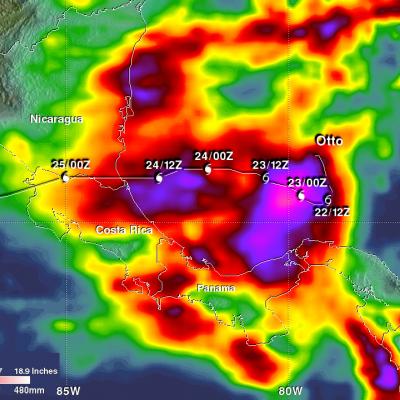
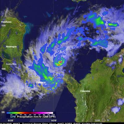
Tropical storm Otto formed in the southwestern Caribbean north of Panama on November 21, 2016. The GPM core observatory satellite had an excellent daytime view of the newly formed tropical storm on November 21, 2016 at 1906 UTC (2:06 PM EST). Otto had wind speeds estimated at 45 kts (52 mph) at that time. GPM satellite rainfall data are shown overlaid on a visible and infrared image captured by the GOES-EAST satellite at 1915 UTC (2:15 PM EST). GPM's Microwave Imager (GMI) and Dual-Frequency Precipitation Radar (DPR) revealed that the newly formed tropical storm had deep convective bursts in

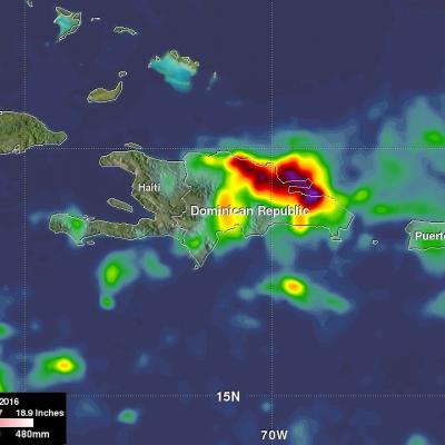
Deadly Tropical Rainfall Examined by IMERG

Scattered to numerous showers and scattered thunderstorms have occurred over Hispaniola during the past week. Slow moving frontal systems draped over Hispaniola and a tropical wave recently caused heavy rainfall that led to wide spread flooding over the northern Dominican Republic. Over 20,000 people have been displaced from their homes and at least five deaths have been reported. A broad area of low pressure (90L) in the southwestern Caribbean is also being monitored for possible tropical cyclone development by the National Hurricane Center (NHC). Very warm sea surface temperatures and upper

Tropical Depression MA-ON Evaluated With GPM Data

Tropical cyclones have been forming frequently in the Western Pacific Ocean since July 2016. 36 named tropical cyclones have formed in the Western Pacific in less than 5 months with 14 of them becoming typhoons. Tropical Depression MA-ON Formed on November 10, 2016 northeast of Guam. MA-ON had maximum sustained winds estimated at 30 kts (34.5 mph) when the GPM core observatory satellite flew over on November 10, 2016 at 0701Z. GPM's Microwave Imager (GMI) and Dual-Frequency Precipitation Radar (DPR) instruments showed that the tropical depression contained some very heavy showers. Strong bands

Tropical Disturbance Threatens India and Bangladesh

A tropical disturbance that recently formed in the Bay Of Bengal may cause heavy rainfall in the next few days along coastal India's eastern state of Odisha and southern Bangladesh. The low is predicted to move northeastward over the warm waters of the Bay Of Bengal but according to the Joint Typhoon Warning Center (JTWC) has only a medium chance of developing into a tropical cyclone. High vertical wind shear is forecast to keep the tropical disturbance from intensifying. The GPM core observatory flew above the low on November 4, 2016 at 0026 UTC. GPM saw that the low contained some strong

Deadly Storms Hit Egypt

Last week severe storms hit Upper Egypt and areas along the Red Sea coast on October 26 and 27, 2016. Egypt normally receives relatively little rain and the heaviest rainfall usually occurs along the Mediterranean coast. Heavy rainfall from intense storms led to flooding in parts of Egypt including the Sohag and Bani Suef in Upper Egypt, the Southern Sinai and the Red Sea. At least 26 deaths and 72 injuries were attributed to the storms. The GPM core observatory satellite routinely passes above that area with a very informative pass occurring on October 27, 2016 at 0541 UTC. Data collected by