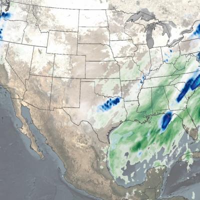
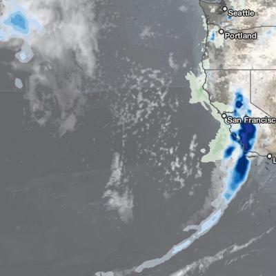
Articles

IMERG Rainfall Totals from Eta & Iota, November 1 - 18
The record-breaking 2020 Atlantic hurricane season, aided by the ongoing La Niña, is officially the most active Atlantic hurricane season on record, surpassing the 2005 season in the total number of named storms with 30 to date. Incredibly, the latest storm Iota wasn’t just another named storm, but a powerful Category 5 hurricane and the strongest storm of the season. It was also only the 2 nd Category 5 storm to occur in the month of November on record, the other being in 1932. The warm waters of the Caribbean continue to serve as a breeding ground for late-season storms this season. Iota
Landslide Risk in Central America
On November 3, 2020, Hurricane Eta made landfall as one of the most powerful hurricanes to hit Central America in years. The category 4 storm destroyed hundreds of homes, killed more than 100 people, and brought torrential rains that triggered large and numerous landslides in Guatemala and Honduras. Less than two weeks later, Hurricane Iota—an even more powerful category 4 storm—nearly retraced Eta’s path. Within hours of Eta’s landfall and flooding rains, researchers at NASA’s Goddard Space Flight Center worked to predict landslides and map the storm’s aftermath. One team assessed potential
GPM Overpass of Hurricane Eta Nov. 11 2020
After a long and meandering journey over Central America, across central Cuba, and through the Florida Keys, Eta, the 28th named storm and 12th hurricane of the 2020 Atlantic hurricane season, wound up nearly stationary as a moderate tropical storm in the southeastern Gulf of Mexico just north of the western tip of Cuba on the morning of November 10th. Before long however, a deep layer trough located over the western third of the US began to shift eastward, and by the afternoon of the 10th, it started to pull Eta back towards the north and the west coast of the Florida peninsula. As it did so
Hurricane Eta over Florida
After striking the northeast coast of Nicaragua as a powerful Category 4 storm back on November 3, Hurricane Eta weakened rapidly over Central America but still brought major flooding and triggered numerous landslides that so far have resulted in at least 250 fatalities across the region, according to media reports. Eta was down to a tropical depression when the center re-emerged over the northwestern Caribbean on the evening of November 5. An upper-level trough over the Gulf of Mexico first steered Eta northeastward towards Cuba on the 6th. Because it was disorganized after its trek across
Hurricane Eta IMERG Screenshot
The extremely active 2020 Atlantic hurricane season, aided by the ongoing La Niña, continues on. After Hurricane Zeta made landfall along the northern part of the Gulf Coast, yet another hurricane has arisen - Hurricane Eta, the strongest of the season. Like Zeta, Eta also formed in the Caribbean, where sea surface temperatures are still running quite warm at around 29° C, almost a full degree above average and well above the typical 26° C needed for tropical cyclone development. But while Zeta turned north into the Gulf of Mexico, Eta moved westward where it delivered powerful winds and