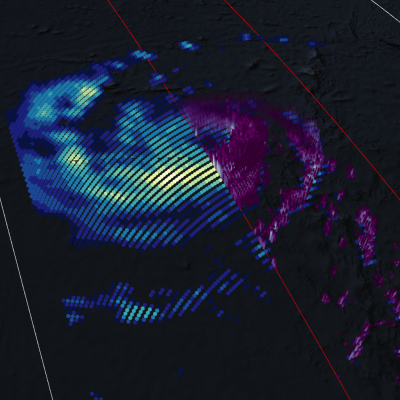
GPM Views Downgraded Hurricane Michael Soaking the Eastern U.S.
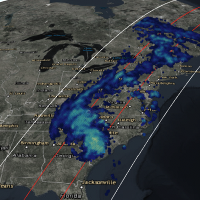
View fullscreen in STORM Event Viewer Hundreds of miles way from its landfall in Mexico Beach, Florida, Michael has been downgraded to a tropical storm, but it continues to pack a punch. Waterlogged regions of the Carolinas from Hurricane Florence are seeing trees toppled in the gusty winds, while rain falling in the Appalachian Mountains is leading to flash flooding and water rescues. Widespread power outages and flooding remain likely as the storm moves to the northeast through the rest of the day.