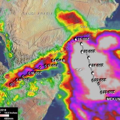
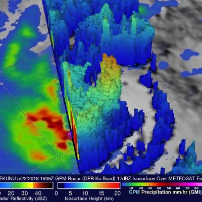
GPM Radar Views Powerful Convective Storms over Saudi Arabia
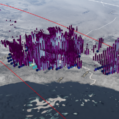
V iew full-screen in STORM Event Viewer Saudi Arabia is not thought of as a region rife with intense thunderstorms, but its southwestern region features an abrupt orographic incline from the Red Sea coast toward the interior. Here, warm moist air can be forceably lifted up the slope of the Sarawat Mountains resulting in torrential downpours and flash flooding. In this overflight, we see an occasion of this, with DPR cloud top heights up to 20km and 89 GHz brightness temperatures near 55K, suggesting the likelihood of hail within the deep convective plume.