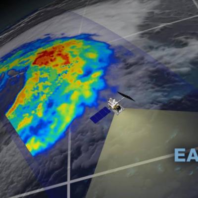
Video credit: Greg Shirah, Kel Elkins, Alex Kekesi (NASA Goddard Scientific Visualization Studio). For more information or to download this public domain video, go to:
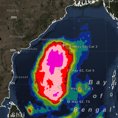
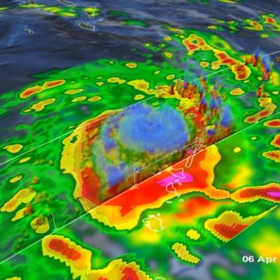
https://svs.gsfc.nasa.gov/4812#29226 A Category 4 cyclone, the most powerful yet of 2020, made landfall on the South Pacific nation of Vanuatu on Monday, not long before this GPM overpass from April 6th, 2020 at 1:41 UTC. Tropical Cyclone Harold developed from a low pressure system that was observed to the east of Papua New Guinea last week, and has tracked to the southeast, where it has already caused flooding and loss of life...