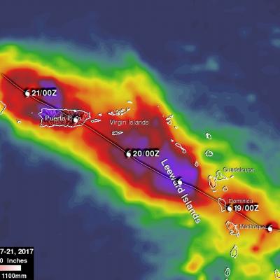
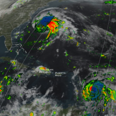
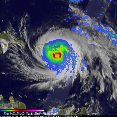
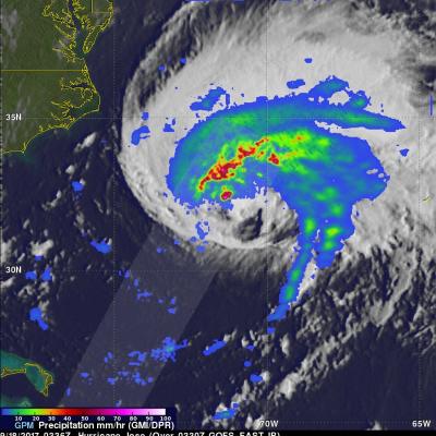
GPM Shows Hurricane Maria North Of Turks And Caicos Islands
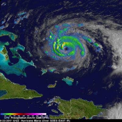
On September 23, 2017 at 8:12 AM AST (1212 UTC) the GPM core observatory satellite had another excellent view of hurricane Maria. The early morning view showed Maria heading north of the Bahamas after battering the Turks and Caicos Islands. Maria had maximum sustained wind speeds of about 121mph (105 kts). Estimates of hourly rainfall at the ocean's surface were derived from GPM's Microwave Imager (GMI) and Dual-Frequency Precipitation Radar (DPR) data. Multiple intense rainfall bands are shown rotating around the western side of the hurricane. Rain was found falling at a rate of over 6.57