Extreme Weather News

Jump to a Year

2024 | 2023 | 2022 | 2021 | 2020

2019 | 2018 | 2017 | 2016 | 2015

2014 | 2013 | 2012 | 2011 | 2010

2009 | 2008 | 2007 | 2006 | 2005

2004 | 2003 | 2002

GPM Sees Possible Tropical Cyclone Forming In The Bay Of Bengal

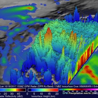
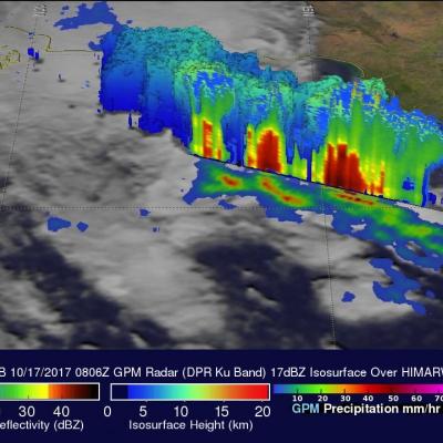
On October 17, 2017 at 0806 UTC the GPM core observatory satellite passed above a low pressure center in the western Bay Of Bengal where a tropical cyclone is probably forming. Warm sea surface temperatures in the Bay Of Bengal are supplying the necessary energy but moderate vertical wind shear observed to the south of the low are counteracting tropical cyclone development. Rainfall rates within the potential tropical cyclone were estimated using data collected by GPM's Microwave Imager (GMI) and Dual-Frequency Precipitation Radar (DPR) instruments. Extremely heavy rainfall accompanied strong

Powerful Hurricane Ophelia Seen Heading Toward Ireland

The GPM core observatory passed directly above hurricane Ophelia on October 14, 2017 at 1656 UTC. Ophelia was a powerful category three on the Saffir-Simpson hurricane wind scale with sustained winds of close to 115 mph (100 kts). GPM's Microwave Imager (GMI) and Dual-Frequency Precipitation Radar (DPR) instruments collected data showing the locations of extremely heavy rainfall with the hurricane. GPM's radar unveiled intense downpours in the northeastern side of Ophelia's eye that were dropping rain at the extreme rate of over 8.4 inches (213 mm) per hour. Other intense feeder bands with
GPM Catches Hurricane Nate's Landfall
NASA's GPM satellite helped track Nate's progress through the Gulf of Mexico and also captured Nate's landfall on the north central Gulf Coast. This animation shows instantaneous rainrate estimates from NASA's Integrated Multi-satellitE Retrievals for GPM or IMERG product over North America and the surrounding waters beginning on Thursday October 5th when Nate first became a tropical storm near the northeast coast of Nicaragua in the western Caribbean until its eventual landfall on the northern Gulf Coast on Sunday October 8th.

Rainfall In Southeast Asia Analyzed By GPM

Tropical storm Khanun formed northeast of the Philippines on October 12, 2017. The GPM core observatory satellite passed above Khanun on October 13, 2017 (0656 UTC) when maximum sustained wind speeds had reached about 45 kts (~52 mph). Khanun had passed over the northern Philippines and was moving into the South China Sea. The approximate location of Khanun's center of circulation is shown with a red tropical storm symbol. The intensifying tropical storm's rainfall is shown in this image courtesy of data collected by GPM's Microwave Imager (GMI) and Dual-Frequency Precipitation Radar (DPR)

Strengthening Tropical Storm Ophelia Observed By GPM

On Monday October 9, 2017 at 1100 AM AST (1500 UTC) tropical depression seventeen (TD17) was upgraded to tropical storm Ophelia. The tropical storm is located over the open waters of the the eastern Atlantic southwest of the Azores. The GPM core observatory satellite had a good view of tropical storm Ophelia on October 10, 2017 at 2:46 PM AST (1846 UTC). GPM's Microwave Imager (GMI) and Dual-Frequency Precipitation Radar (DPR) revealed that the storm was organized but most of the rainfall in the storm was only of light to moderate intensity. The area covered by GPM's 151.9 mile wide (245 km)