Alex Becomes the Earliest Hurricane to Form in the Atlantic Since 1938
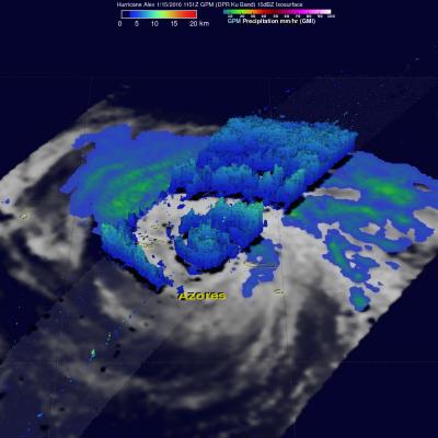
Alex is a rare storm indeed. Alex officially became a hurricane yesterday at 11:00 am Atlantic Standard Time (AST) with maximum sustained winds estimated at 85 mph by the National Hurricane Center (NHC), making it the earliest hurricane to form in the Atlantic since 1938, when the first storm of the season became a hurricane on the 4th of January. As with Alex, that storm too originated from an extratropical low pressure center. The last hurricane to occur in January was Hurricane Alice in 1955, but Alice had already become a hurricane in the year before at the end of December and survived