Extreme Weather News

Jump to a Year

2022 | 2021 | 2020 | 2019 | 2018

2017 | 2016 | 2015 | 2014 | 2013

2012 | 2011 | 2010 | 2009 | 2008

2007 | 2006 | 2005 | 2004 | 2003

2002

GPM Sees More Powerful Tropical cyclone 06P (ULA)

The GPM core observatory satellite had an excellent daytime view of tropical cyclone 06P (ULA) on December 30, 2015 at 2358 UTC. The tropical cyclone had moved to the east-southeast of Samoa in the South Pacific Ocean with maximum sustained winds increasing to about 50 kts (58 mph). The rainfall pattern derived from GPM's Microwave Imager (GMI) and Dual-Frequency Precipitation Radar (DPR) instruments showed that 06P was much better organized. Powerful thunderstorms at the center of the tropical cyclone were found by DPR to be dropping rain at a rate of over 66 mm (2.6 inches) per hour. GPM's

GPM Sees Tropical Cyclone Forming

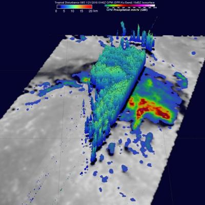
The GPM core observatory satellite passed above tropical cyclone 06P when it was forming in the south Pacific Ocean north of Samoa on December 29, 2015 at 1321 UTC. A rainfall analysis was performed using data collected at that time by GPM's Microwave Imager (GMI) and Dual-Frequency Precipitation Radar (DPR) instruments. Data from GMI were used to calculate that rain was falling at a rate of over 83.6 mm (3.29 inches) per in a feeder band northeast of the low's center. Radar data from GPM's DPR Ku band radar were used to show the 3-D structure of precipitation within the forming tropical

Paraguay's Deadly Flooding Rainfall Measured By IMERG

Widespread flooding has recently affected tens of thousands of people in South America. Paraguay has been especially hard hit with the worst flooding in decades occurring after heavy summer rainfall. An estimated 90,000 people have been evacuated from their homes. Storms and flooding caused the deaths of at least six people in Asuncion, Paraguay. The analysis above was generated using the Integrated Multi-satellitE Retrievals for GPM (IMERG) data product. IMERG rainfall estimates are computed in near-realtime. IMERG data indicates that over 350 mm (13.8 inches) of rain fell northeast of

NASA Looks At Deadly Weather Over the US

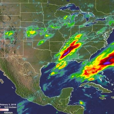
Heavy rainfall, flooding and tornado outbreaks affected areas of the United States from the Southwest through the Midwest from December 23-27, 2015. Tornadoes and flooding events killed at least 43 people during this period. Fourteen deaths alone occurred with tornadoes that hit Benton, Mississippi on December 23, 2015. Tornadoes are expected in the springtime but are much less frequent during this time of the year. An analysis was made of the rainfall that occurred during the period from December 21-28, 2015. This analysis used data generated by NASA's Integrated Multi-satellitE Retrievals

Typhoon Melor Rainfall Measured By IMERG

Since landfall typhoon Melor has destroyed thousands of homes and caused the deaths of at least six people in the Philippines. Melor had hurricane force during most of the time it spent moving through the central Philippines and weakened to tropical storm intensity only after moving into the South China west of the Luzon. Heavy rainfall from the typhoon also caused some flooding along it's path. An analysis of typhoon Melor's rainfall was made using data from NASA's Integrated Multi-satellitE Retrievals for GPM (IMERG). Total rainfall in the area of typhoon Melor from December 12-16, 2015 is