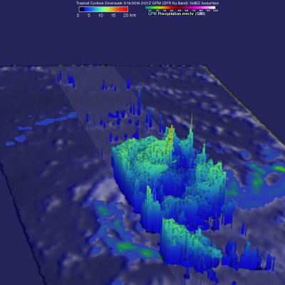
GPM Views Tropical Cyclone Zena Hitting Vanuatu
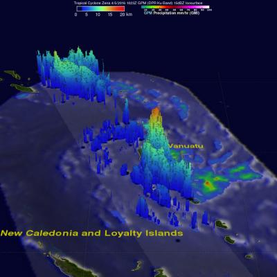
Tropical Cyclone Zena (18P) formed in the South Pacific Ocean near Vanuatu early on April 5, 2016. The GPM core observatory satellite flew directly above the newly formed tropical cyclone on April 5, 2016 at 1023 UTC. Intensifying tropical cyclone Zena was buffeting Vanuatu with sustained winds estimated to be over 35 kts (40 mph). A rainfall analysis derived from GPM's Microwave Imager (GMI) and Dual-Frequency Precipitation Radar (DPR) instruments shows that very powerful storms moving through the islands were dropping rain at a rate of almost 154 mm (6 inches) per hour in intense downpours