Rainfall Causes Texas and Oklahoma Flooding
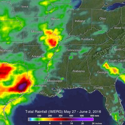
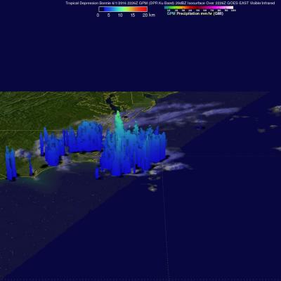
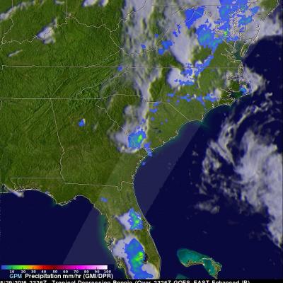
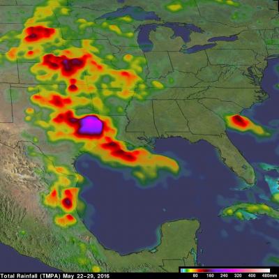
Continuing heavy rain has resulted in dangerous flooding conditions from Oklahoma through eastern Texas. The Brazos, Trinity and Colorado Rivers in Southeastern Texas are at or above flood stage. Flooding resulted in the deaths of at least 6 people in Texas during the past week. Governor Greg Abbott declared a state of disaster in 31 Texas counties. Over 20 inches of rainfall were reported in some areas since May 30, 2016. Parts of Georgia and the Carolinas were flooded by very slow moving tropical depression Bonnie. This estimate of rainfall totals from May 27, 2016 to June 2, 2016 was made