Philippines

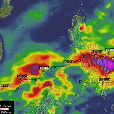
GPM Observes Dangerous Super Typhoon Heading Toward The Philippines

The GPM core observatory satellite has recently provided very useful information about super typhoon MANGKHUT in the western Pacific Ocean. A few days ago MANGHUT battered the Marianas Islands. MANGKHUT's destructive winds pounded the island of GUAM causing power outages and it's extremely heavy rainfall caused flash floods. The GPM core observatory satellite passed over super typhoon MANGKHUT on September 11, 2018 at 0407 UTC when it was west of GUAM. GPM's Microwave Imager (GMI) and Dual-Frequency Precipitation Radar (DPR) collected data showing that MANGKHUT was a large and very well

Tropical Storm Tembin Rainfall Added To IMERG Analysis

Tropical storm Tembin moved over the Philippine island of Mindanao on Friday December 22, 2017. Tembin added to the death and destruction already caused by tropical storm Kai-Tak that hit the central Philippines less than a week ago. Tembin brought heavy rainfall that resulted in more deadly flooding and landslides. At least eight deaths in the Philippines have been blamed on tropical storm Tembin. Rainfall totals in this accumulation analysis were updated to include IMERG data from both tropical storms Kai-Tak and Tembin. This rainfall analysis shows rainfall accumulation estimates from IMERG

Deadly Tropical Storm Kai-tak Examined With IMERG And GPM Satellite

Tropical storm KAI-TAK was nearly stationary at times as it drenched the Philippines during the past five days. The storm caused major flooding and landslides. Many homes, roads and bridges were reported destroyed by landslides. Over 30 deaths were caused by the slow-moving tropical storm. A rainfall accumulation analysis of tropical cyclone KAI-TAK was derived from NASA's Integrated Multi-satellitE Retrievals data (IMERG) for the period from December 13-18, 2017. Tropical cylone KAI-TAK's approximate locations and positions are shown overlaid in white on this analysis. IMERG data were used to

Typhoon Nock-ten's Rainfall Measured By IMERG

Heavy rainfall and winds from super typhoon Nock-ten caused the deaths of at least six people as it roared through the Philippines. Data generated by NASA's Integrated Multi-satellitE Retrievals for GPM (IMERG) were used to estimate the total amount of rain that super typhoon Nock-ten dropped as it approached and traveled over the Philippines. Nock-ten’s approximate locations and appropriate tropical cyclone symbols at 0000Z and 1200Z are shown overlaid in white on IMERG rainfall estimate images. This IMERG analysis shows estimated rainfall totals using NASA's IMERG data produced during the

Typhoon Haima Hits China After Devastating The Northern Philippines

After Haima's caused extensive destruction and at least 13 deaths in the northern Philippines the typhoon traveled across the South China Sea to batter Hong Kong and mainland China. Heavy rain and gusty winds accompanied Haima as the typhoon passed to the east of Hong Kong. Operations at Hong Kong's international airport were nearly stopped by the typhoon. At least one person was reported killed in Hong Kong. Haima made landfall in China 110 km (68 miles) east of Hong Kong at about 0400 UTC (noon CST). Haima's winds were decreasing and the typhoon was the equivalent of a category one hurricane

Typhoon Melor Rainfall Measured By IMERG

Since landfall typhoon Melor has destroyed thousands of homes and caused the deaths of at least six people in the Philippines. Melor had hurricane force during most of the time it spent moving through the central Philippines and weakened to tropical storm intensity only after moving into the South China west of the Luzon. Heavy rainfall from the typhoon also caused some flooding along it's path. An analysis of typhoon Melor's rainfall was made using data from NASA's Integrated Multi-satellitE Retrievals for GPM (IMERG). Total rainfall in the area of typhoon Melor from December 12-16, 2015 is

GPM Sees Super Typhoon Melor Hitting The Philippines

Super typhoon Melor (known in the Philippines as Nona) formed east of the Philippines on December 12, 2015. Melor became more powerful and became a typhoon the next day while heading toward the Philippines. The Joint Typhoon Warning Center (JTWC) indicated that Melor was a super typhoon with winds of 115 kts 115 kts (133 mph) just before hitting the Philippines .The GPM core observatory satellite passed above as super typhoon Melor was impacting the Philippines on December 14, 2015 at 1006 UTC. At that time Melor still had maximum sustained winds of about 115 kts (133 mph). Rainfall derived

Typhoon Koppu's Deadly Philippine Rainfall

Extremely heavy rainfall from super typhoon Koppu has caused deadly flooding and mudslides in the Philippines. Koppu hit the eastern coast of Luzon as a category four super typhoon with winds of 130kts (150 mph). Koppu weakened but was still battering the Philippines as a typhoon after reaching the Lingayen Gulf on Luzon's western coast. Typhoon Koppu then made a turn toward the north and continued to drench the northern Philippines as it followed Luzon's northwestern coast. Torrents of rain flowing from mountainous terrain magnified the effects of very high rainfall totals. A rainfall

GPM Sees Tropical Storm Koppu Menacing The Philippines

Tropical storm Koppu was approaching the Philippines with sustained winds estimated of 60 kts (69 mph) when the GPM core observatory satellite passed above on October 15, 2015 at 1436 UTC. A rainfall analysis using data collected by GPM's Microwave Imager (GMI) instrument revealed that an eye was very close to forming near Koppu's center of circulation. Rain was measured by GPM's GMI instrument dropping rain at a rate of over 133 mm (5.3 inches) per hour in intense convective thunderstorms just southwest of Koppu's center. Data from GPM's Dual-Frequency Precipitation Radar (DPR) instrument

Tropical Storm Koppu Heads Toward The Philippines

Tropical storm KOPPU that recently formed northwest of Guam in the western Pacific Ocean may threaten the Philippines in the next five days. A recent prediction by the Joint Typhoon Warning Center (JTWC) indicates that tropical storm KOPPU will intensify to typhoon intensity while heading westward toward the northern Philippines. The GPM core observatory satellite flew over tropical storm KOPPU on October 13, 2015 at 0316 UTC. Data collected with GPM's Microwave Imager (GMI) and Dual-Frequency Precipitation Radar (DPR) instruments shows that numerous intense thunderstorms near the tropical