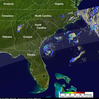
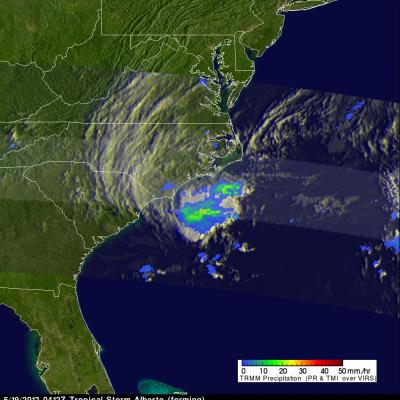
Tropical Depression Beryl Drenches Florida And Georgia
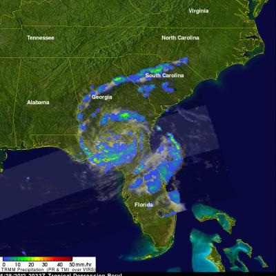
At times Tropical storm beryl has been producing intense rainfall over the southeastern United States since coming ashore early on Monday May 28, 2012. The TRMM satellite had good views of Beryl's rainfall on Monday May 28, 2012 at 2033 UTC (4:33 PM EDT) and on Tuesday May 29, 2012 at 0127 UTC (Monday May, 28 2012 at 9:27 PM EDT). Data from TRMM's Microwave Imager (TMI) and Precipitation Radar (PR) are shown in two images from those orbits. These TRMM images show that bands of rainfall rotating around Beryl were mainly affecting only northern Florida and southeastern Georgia. A few areas of