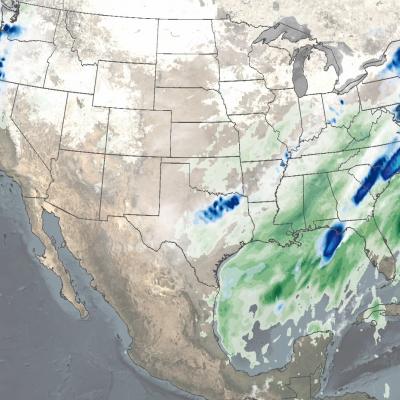
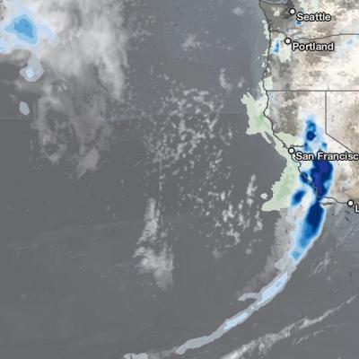
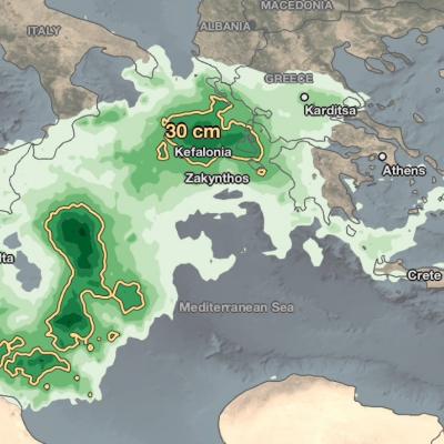
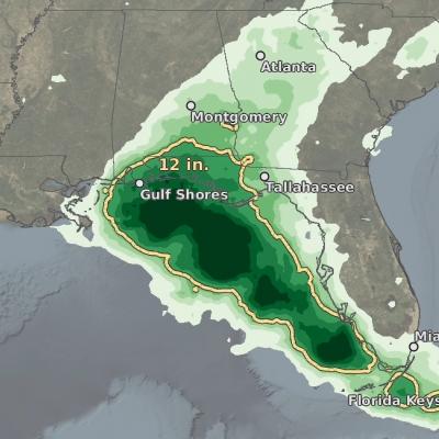
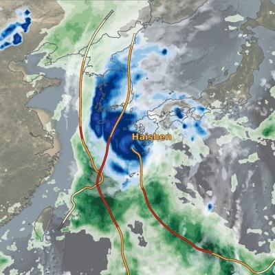
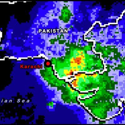
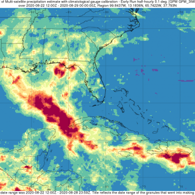
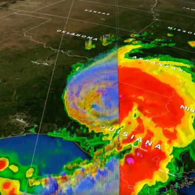
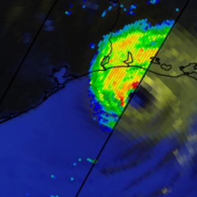
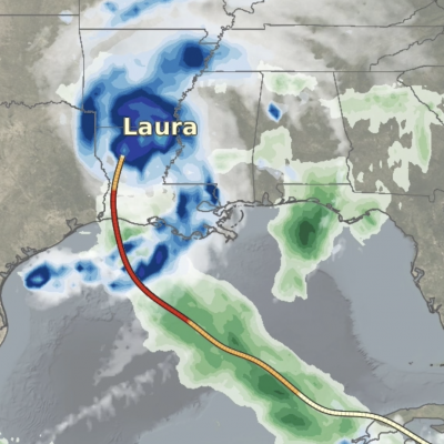
Weather

Earth’s climate is changing. The accumulation of greenhouse gases has affected the oceans and ice systems as well as the atmosphere, which in turn impacts the water cycle. To predict future changes in weather and climate and estimate environmental variables, scientists use sophisticated computer models. These models rely on available global data to describe the conditions that exist today to project how conditions may change in the future. GPM’s Weather, Climate, and Land Surface Modeling Applications area promotes the use of precipitation measurements from GPM satellites to help model future behavior of precipitation patterns and climate. 

IMERG Hurricane Hanna 7-27-20 cropped
Hanna formed from a westward propagating tropical easterly wave that entered the southeast corner of the Gulf of Mexico on Tuesday July 21st. The wave provided a focus for shower and thunderstorm activity, which then led to the formation of an area of low pressure over the central Gulf of Mexico. The National Hurricane Center (NHC) found that this low had developed a closed circulation by the evening of Wednesday July 22nd, making it Tropical Depression #8. Over the next 24 hours, the depression slowly organized and intensified over the central Gulf before reaching tropical storm intensity on
GPM Hurricane Douglas 7-25-20
Hurricane Douglas continued to approach the Hawaiian islands during this GPM overpass early in the morning (02:11 UTC) of July 25, 2020. Douglas had previously strengthened to a Category 4 hurricane the day before, but had substantially weakened over cooler waters throughout the day. Regardless, the GMI and DPR instruments recorded rain rates near 50 millimeters/hour (~2 inches/hour) near Douglas` center. The Central Pacific Hurricane Center advised residents of Hawaii to expect hurricane-strength winds and rainfall starting Saturday evening and lasting through Monday. View fullscreen in STORM
IMERG rainfall totals from Japan, July 3 - 9 2020
From July 3-9, 2020, NASA’s IMERG algorithm continued to observe the heavy precipitation that fell as part of the seasonal Meiyu-Baiu rains (“plum rains”) in east Asia. Weekly totals reached their regional maxima over the island of Kyushu in southern Japan. About half of the island of Kyushu received over 45 cm (~18 inches) of rain. The majority of Honshu, Japan’s main island, as well as Shikoku to its south, were also impacted by the rains, receiving from 10-25 cm, depending on the location. Additionally, large areas of eastern China were also covered by the plum rains during this weekly
IMERG rainfall totals from Japan, June 29 - July 5, 2020
This animation shows NASA IMERG rain rates (blue shading) and accumulations (green shading) near Kyushu island, in the southwest of Japan from June 29 - July 5, 2020. Devastating floods and landslides swept through parts of Kyushu on July 4, 2020, resulting in over 40 deaths and orders for hundreds of thousands of people to evacuate their homes according to media reports. Download video (right-click -> Save As) The rains that triggered the flooding occurred in the context of the Meiyu-Baiu rainy season, which arrives in east Asia every year from June to mid-July. “Meiyu” and “Baiu” are the
GPM Overpass of Hurricane Dorian
Tropical cyclones, known as hurricanes in the western hemisphere, can bring damaging high winds, storm surge, and flooding rainfall to the coastal communities they hit. Satellite instruments - and the detailed near real-time atmospheric data that they provide - have revolutionized the way we see hurricanes and other disasters as they happen. But it’s about more than just seeing. NASA, working with counterparts at NOAA, FEMA, and elsewhere are sharing ever more precise data to aid local communities in coping with disasters. With better information, emergency responders have the tools to make...
Cyclone Amphan IMERG Rainfall Totals
On May 16, 2020, NASA / JAXA's GPM Core Observatory satellite observed the early stages of Tropical Cyclone Amphan as it tracked north over the Bay of Bengal. The below GPM overpass shows precipitation within Cyclone Amphan a day before it explosively intensified into a category 4-equivalent cyclone. Even at this early stage, Amphan produced heavy rain rates near its center and to its west and southwest. View fullscreen in STORM Event Viewer NASA monitored the heavy rain associated with Tropical Cyclone Amphan as it made landfall at 0900 UTC (2:30 PM local time) on May 20, 2020. Landfall...
Typhoon Vongfong IMERG Rainfall Totals
The first typhoon of the season, Vongfong, struck the central Philippines this past week (where it is known as Ambo) as a strong category 2 storm, bringing strong winds and locally heavy rainfall. Vongfong formed into a tropical depression in the southern Philippine Sea west of Palau on Sunday May 10th from a disturbance that had been slowly making its way westward over the past several days. After becoming a depression, the system moved northward toward the central Philippine Sea and slowly began to intensify. Then, on the 12th when it reached tropical storm intensity, Vongfong’s northward...
Extratropical Storm Dennis, February 15, 2020
Storm Dennis is an extratropical cyclone that developed over the continental United States before undergoing explosive intensification as it crossed into the North Atlantic. On February 15 shortly after this GPM overpass, Dennis reached its minimum central pressure of 920 mb, which is reported to be the second-lowest on record for a North Atlantic winter storm. The eye can be seen south of Iceland, while rain bands to the south caused severe flooding across the British Isles. Text & Visualization by Jason West (NASA / KBR)
Typhoon Kammuri Hits the Central Phiippines
While the Atlantic hurricane season officially ended on November 30th, Typhoon Kammuri (known as Tisoy in the Philippines), which recently struck the central Philippines as a powerful Category 4 typhoon, is a reminder that the Pacific typhoon season is not yet over. In fact, while typhoon season does peak from around June through November, similar to the Atlantic, typhoons can occur throughout the year in the Pacific. Kammuri first formed into a tropical depression from an area of low pressure on the 25th of November north of Micronesia in the west central Pacific about 500 miles southeast of Guam.
Typhoon Hagibis Brings Heavy Rains to Japan
Typhoon Hagibis, a once powerful super typhoon, struck the main Japanese island of Honshu over the weekend, bringing very heavy rains and widespread flooding. Hagibis formed into a tropical storm on the 5th of October from a tropical depression that originated from a westward moving tropical wave north of the Marshall Islands. At first, Hagibis strengthened steadily becoming a typhoon about 24 hours after becoming a tropical storm. But, then on the 7th, Hagibis underwent a remarkable rapid intensification cycle and quickly intensified into a super typhoon with sustained winds estimated at 160 mph by the Joint Typhoon Warning Center (JTWC) less than 24 hours after becoming a minimal typhoon.