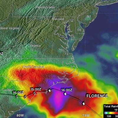
GPM IMERG Adds Up Heavy Rainfall from Typhoon Mangkhut
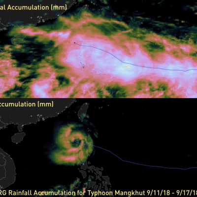
#NASA's GPM IMERG data product was used to estimate the devastating heavy rainfall that fell on China and the Philippines from #TyphoonMangkhut. This video shows storm-total and 3-hourly precipitation accumulations from 9/11/17 - 9/17/18. Learn more: https://t.co/8PzhK9pCDW pic.twitter.com/x6gf6N8VWH — NASA Precipitation (@NASARain) September 18, 2018 In the past week, Typhoon Mangkhut has affected the Philippines, mainland China, and Hong Kong, as shown in this 7-day animation of NASA's satellite-based IMERG precipitation product. The upper frame shows the storm-total accumulation starting at