Extreme Weather News

Jump to a Year

2024 | 2023 | 2022 | 2021 | 2020

2019 | 2018 | 2017 | 2016 | 2015

2014 | 2013 | 2012 | 2011 | 2010

2009 | 2008 | 2007 | 2006 | 2005

2004 | 2003 | 2002

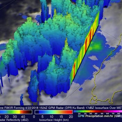
GPM Sees Tropical Cyclone Fakir Forming Near Madagascar

The southwest Indian Ocean cyclone season started on November 15, 2017 and will officially end on April 30, 2018. A tropical cyclone labeled FAKIR by Meteo France formed today near northeastern Madagascar. FAKIR is expected to intensify as it moves toward the southeast and could be a significant tropical cyclone tomorrow. This cyclone season has already seen Madagascar battered and drenched by tropical cyclones Ava, Dumazile, and Eliakim. The GPM core observatory satellite flew above the forming late season tropical cyclone near northeastern Madagascar on April 22, 2018. The satellite's

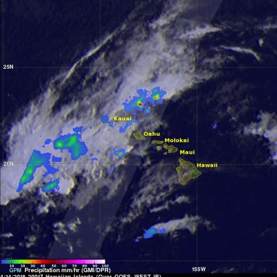
GPM Data Used to Evaluate Hawaii's Flooding Rainfall

A low pressure trough moving slowly westward through the northwestern Hawaiian Islands caused destructive flooding and mudslides over the past weekend. The trough disrupted the normal northeast trade winds flow north of Oahu on April 12, 2018. This caused extremely heavy rainfall as the trough deepened and moved very slowly over Kauai during the weekend. The 28.1 inches (713 mm) of rain reported in Hanalei within a 24 hour period was close to a record for the small town on Kauai's northern coast. Almost 32.4 inches (822 mm) of rain was reported during the same period over Wainiha, Kauai

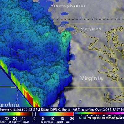
GPM Catches Line of Strong Storms Responsible For Tornadoes in Eastern U.S.

Yesterday, Sunday April 15th, a line of strong storms at one point stretched from the Florida Straits below the Florida Keys all the way up the East Coast and into Ohio. Many of the storms were strong with wide spread reports of wind damage from north Florida up through the Carolinas and into central Virginia. Among these were several reports of tornadoes from Florida to Virginia. The most significant were an EF-2 tornado that stuck Greensboro, NC, killing one person, and a tornado near Lynchburg in Amherst County Virginia that injured 8 people. GPM captured this image of the advancing line of

Tropical Cyclone Keni Drops Heavy Rain Over Fiji With A Direct Hit To Kadavu

As expected, tropical cyclone KENI followed a track similar to tropical cyclone JOSIE and passed to the southwest of Fiji's main island of Viti Levu on April 10, 2018 (UTC). No casualties were reported with KENI even though it was a more powerful tropical cyclone than JOSIE. KENI was still intensifying when it passed directly over the island of Kadavu located just south of Viti Levu. Flash flooding was reported on Viti Levu and Kadavu. Maximum sustained winds of greater than 70 kts (81 mph) were responsible for widespread damage caused by the direct hit to Kadavu. KENI's peak winds of 85 kts

GPM Sees Keni Following Tropical Cyclone Josie's Track

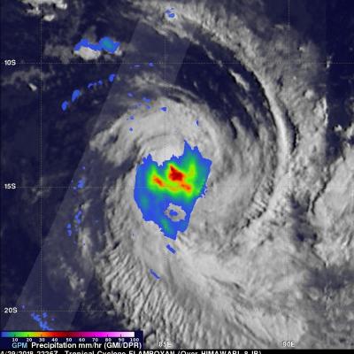
Another tropical cyclone called KENI has formed in the South Pacific Ocean between Vanuatu and Fiji. The Joint Typhoon Warning Center (JTWC) issued it's first warning for tropical cyclone KENI on April 8, 2018 at 2100Z. Tropical cyclone KENI is following a track similar to tropical cyclone JOSIE that recently caused deadly flooding in Fiji. The GPM core observatory satellite passed above tropical cyclone KENI on April 9, 2018 at 1109Z. This analysis of rainfall around tropical cyclone KENI was accomplished using data collected by GPM Microwave Imager (GMI) and Dual Frequency Precipitation