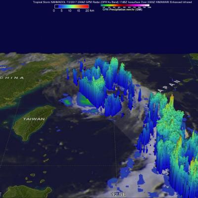
Rainfall In Potential Tropical Cyclone Analyzed
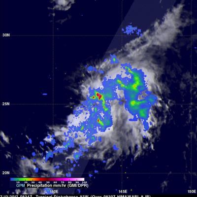
A tropical cyclone may be forming in the northwestern Pacific Ocean near Chichi-Jima, Japan. The GPM core observatory satellite flew directly above very strong convective storms in this potential tropical cyclone on July 13, 2017 at 0834 UTC. Rainfall in the area was analyzed using data collected by GPM's Microwave Imager (GMI) and Dual-Frequency Precipitation Radar (DPR) instruments. One area of extremely intense storms was measured by GPM's radar (DPR Ku Band) dropping rain at a rate of over 198mm (7.8 inches) per hour. Data from the GPM satellite's radar (DPR Ku band) was also used to