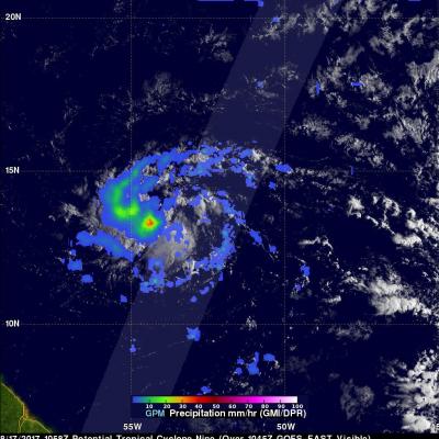
GPM Sees New Tropical Storm Harvey
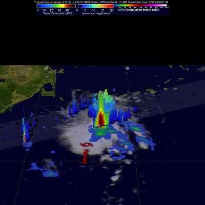
The National Hurricane Center (NHC) upgraded a tropical disturbance that they were monitoring east of the Lesser Antilles to Tropical storm Harvey on August 17, 2017 at 5:00 PM EDT (2100 UTC). The GPM core observatory satellite flew over newly designated tropical storm Harvey on August 17, 2017 at 6:21 PM EDT (2221 UTC). Easterly vertical wind shear was causing the strongest convection to be pushed to the west of the tropical storm's center of circulation. GPM's Microwave Imager and Dual-Frequency Precipitation Radar (DPR) found that some of these strong convective storms were dropping very