Extreme Florida Rainfall Examined With GPM
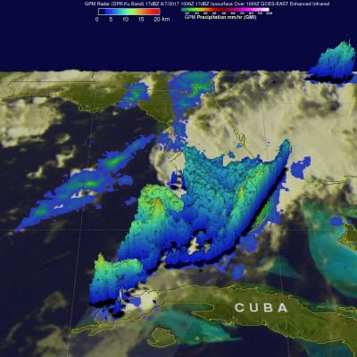
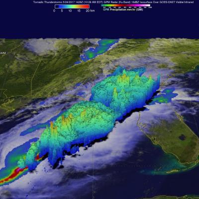
Extremely heavy rain has recently fallen over Florida. Over 19 inches (482 mm) of rain has fallen in southeastern Florida during the past seven days. Record rainfall has been reported in Fort Lauderdale and West Palm. This extreme rainfall has led to flooding and flight cancellations. The GPM core observatory satellite flew above southern Florida on Wednesday June 7, 2017 at 6:06 AM EDT ( 1006 UTC). Data collected by GPM's Microwave Imager (GMI) and Dual-Frequency Precipitation Radar (DPR) instruments revealed the intensity of rainfall within powerful storms that were drenching southern