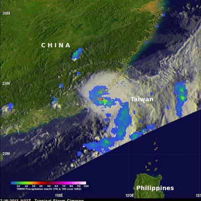
TRMM Sees Strong Tropical Storm Cimaron
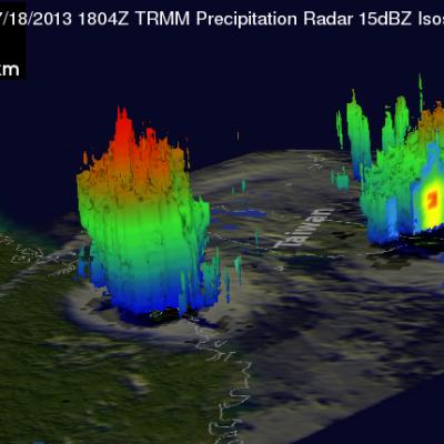
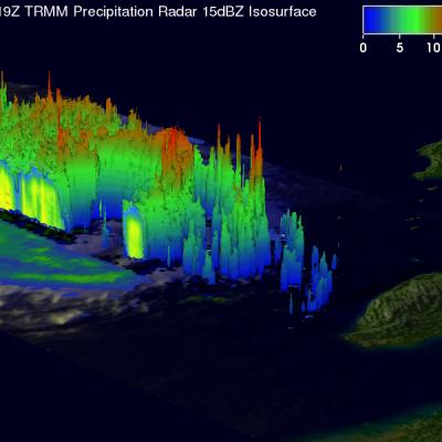
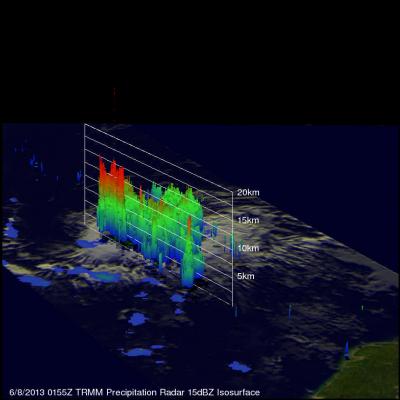
The TRMM satellite had another excellent view of tropical storm Cimaron near the coast of China on July 18, 2013 at 1804 UTC. This TRMM pass showed that Cimaron still contained some powerful thunderstorms. Some of these storms were found by TRMM's Precipitation Radar (PR) instrument to be dropping rain at a rate of over 141mm/hr (~5.6 inches). Some of this heavy rainfall was returning values of over 54dBZ to the satellite. Tropical storm Cimaron dissipated quickly after coming ashore but produced heavy rainfall that caused flooding in China's Fujian Province. This 3-D view from TRMM's