GPM Applications: Weather

Using GPM Data for Weather, Climate, and Land Surface Modeling

Using GPM Data for Weather, Climate, and Land Surface Modeling

Variations in rain, snow, and other forms of precipitation are an integral part in everyday weather and long term climate trends. Initialization of short-term weather and long-term climate models with accurate precipitation information enhances their prediction skills and extends their skillful lead times. To get the resolution and temporal coverage to measure precipitation across the globe, we often rely on satellite information. Satellite data can play a fundamental role in our ability to monitor and predict weather systems as well as to forecast future changes to our climate and land surface. Satellite data from GPM’s suite of precipitation products are integrated into numerical weather prediction models that are operated by operational partners to provide and improve the observations from which the forecasts are then generated. Similarly, climate and land surface models use satellite precipitation observations from GPM to describe the conditions that exist today in order to project how conditions may change in the future. The Weather, Climate, and Land Surface Modeling applications area promotes the use of GPM data to help monitor existing weather activity and model future behavior of precipitation patterns and climate.

Overview

Variations in rain, snow, and other forms of precipitation are an integral part in everyday weather and long term climate trends. Initialization of short-term weather and long-term climate models with accurate precipitation information enhances their prediction skills and extends their skillful lead times. To get the resolution and temporal coverage to measure precipitation across the globe, we often rely on satellite information. Satellite data can play a fundamental role in our ability to monitor and predict weather systems as well as to forecast future changes to our climate and land surface. Satellite data from GPM’s suite of precipitation products are integrated into numerical weather prediction models that are operated by operational partners to provide and improve the observations from which the forecasts are then generated. Similarly, climate and land surface models use satellite precipitation observations from GPM to describe the conditions that exist today in order to project how conditions may change in the future. The Weather, Climate, and Land Surface Modeling applications area promotes the use of GPM data to help monitor existing weather activity and model future behavior of precipitation patterns and climate.

Sections

GPM Data for Decision Making

Image

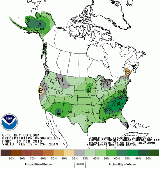
NOAA’s Climate Prediction Center (CPC) issues extended range outlook maps for 6-10 days in the future. The above figure shows a 6-10 forecast of precipitation probability for the first week of October 2018. This product complements short-range weather forecasts issued by other components of the National Weather Service. Credit: NOAA/NCEP/CPC
 

Numerical weather prediction (NWP) is the use of computer models to predict upcoming weather. Specifically, NWP centers rely on microwave-based satellite rainfall information, such as data retrieved from GPM’s GMI, to improve short- to long-term weather forecasts and correct track forecasts for tropical cyclones. In addition, NWP centers create precipitation products for “nowcasting” weather in the immediate 1-5 hours (e.g. using near-real-time rainfall data from GPM) to meet the needs of a wider user community, including weather forecasters, hydrologists, farmers, numerical modelers, the military and the climate community. Methods for integrating rainfall data are constantly evolving and advancing, and with GPM’s advanced instruments, scientists can influence and enhance their scientific research and benefit socioeconomic activities.

Image

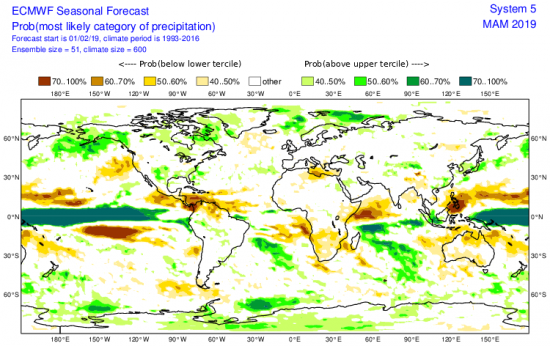
European Centre for Medium-Range Weather Forecast (ECMWF) Seasonal Forecast of precipitation probability. Percent probability is determined by using the predictive anomaly relative to 24 years of observed precipitation from 1993-2016. Credit: European Centre for Medium-Range Weather Forecast
 

To understand the changing climate and make future climate predictions, scientists need to use sophisticated computer models to recreate Earth’s climate conditions. Understanding current rainfall and snowfall variability, among other climate factors on regional and global scales, helps scientists model future behavior of precipitation patterns and climate. But for a system as complicated as the Earth, the models are only as good as the data provided. Satellite precipitation measurements from GPM and its predecessor TRMM provide global scale observational data sets that are comprehensive and consistent over long time periods, two characteristics scientists need to understand the relationships between different parts of the climate system. Specifically, organizations use GPM and TRMM data as input to verify and validate their seasonal and climate model simulations. The ultimate goal is to be able to predict changes in climate on time scales as short as the next hurricane season and as far into the future as changes that may occur in the coming decades or centuries. 

Image

Climate change may lead to an increase in temperatures and a decrease in snowpack within the Absaroka Range, found at the eastern edge of Yellowstone National Park. Credit: National Park Service/Neal Herbert
 

Precipitation is the fundamental driver of land surface hydrological processes and a key component of the terrestrial water cycle, which in turn affects the functioning of atmospheric and climate processes. High-resolution modeling of land surface hydrological processes requires detailed rainfall estimates as inputs to improve understanding of the state of the water cycle and impacts on land-surface processes during extreme events. Satellite precipitation data from GPM is integrated into land surface models to study surface features and how they change due to manmade and natural conditions such as urbanization and erosion. The use of GPM precipitation data together with other satellite data including soil moisture within land surface models will improve weather and hydrological prediction, which will help city planners and even decision makers save lives. 

Weather & Climate Featured Resources

Jump to a Year

2022 | 2021 | 2020 | 2019 | 2018

2017 | 2016 | 2015 | 2014 | 2013

2012 | 2011 | 2010 | 2009 | 2008

2007 | 2006 | 2005 | 2004 | 2003

2002

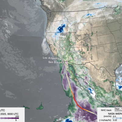
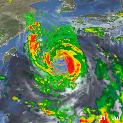
GPM overpass of Typhoon Nanmadol
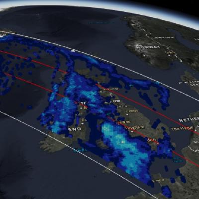
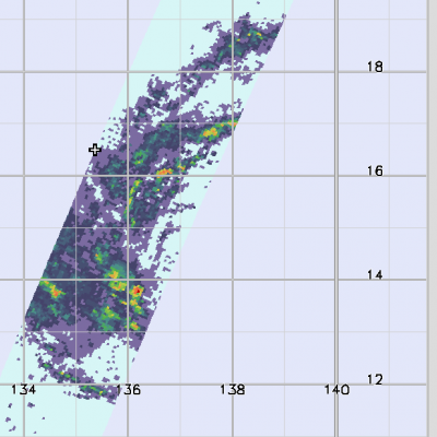
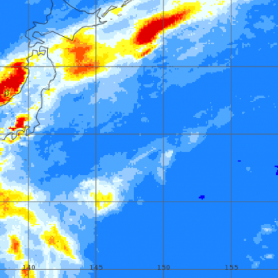
Super Typhoon Nanmadol became one of the strongest typhoons to threaten Japan since records began in 1951. Nanmadol began as a tropical disturbance, basically an area of active thunderstorms, on September 11th southeast of Iwo Jima about midway between Tokyo and Guam. After moving to the southwest for 2 days, this disturbance became better organized and formed into a depression on the 13th. The system then made a counterclockwise loop, moving first back to the northeast before turning back again towards the west. Over this time, the system slowly intensified, becoming Tropical Storm Nanmadol
IMERG totals from twin cyclones in the Indian Ocean
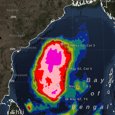
Over the past several days, a relatively rare event occurred in the eastern Indian Ocean: the formation of “twin” tropical cyclones. Tropical Cylones Karim and Asani formed at nearly the exact same time (06:00 UTC and 06:30 UTC, 12:00 pm and 12:30 pm local time) on May 7 on opposite sides of the Equator. Karim officially formed first in the southern hemisphere (SH) followed immediately by Asani in the northern hemisphere (NH). At first glance, the cyclones appear to be mirror images of one another with Asani rotating counterclockwise in the NH and Karim rotating clockwise in the SH roughly
IMERG rainfall totals in South Africa, April 5 - 18, 2022.
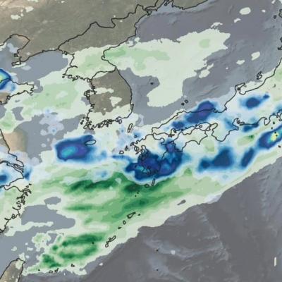
An upper-level area of low pressure tapped into the warm waters of the South Indian Ocean to bring heavy rains and flooding to parts of South Africa during the second week of April. The event unfolded when an upper-level trough of low pressure embedded within the midlatitude westerlies traversed the southern part of Africa from west to east. As the trough approached the east coast of South Africa, an area of low pressure became detached from the main flow, this “cut off” low then drifted over the warm waters of the Agulhas Current, which channels warmer waters from the tropical Indian Ocean
GPM Overpass of Typhoon Surigae
Although it was only the 2nd named storm of the 2021 Pacific typhoon season, Typhoon Surigae became not only the first super typhoon of the season, but also the strongest tropical cyclone of 2021 worldwide. The majority of storms in the Northwest Pacific region form between June and Nov., but the season runs yearlong, as storms can form in any month in this region, which stretches from 100 degrees East to 180 degrees East, north of the equator. Surigae originated from an area of low pressure about 700 miles south of Guam. Persistent thunderstorm activity resulted in the formation of a tropical
IMERG Rainfall Totals from Australian :"Rain Bomb" in March 2022
The below animation shows surface rainfall estimates from NASA’s IMERG multi-satellite precipitation product for the week starting on Feb. 22, 2022 at 0000 UTC and ending on Feb. 28, 2022 at 2330 UTC. Areas shaded in blue and yellow show three-hour average snapshots of IMERG rain rates every half-hour overlaid on cloudiness (shown in white/gray) based on geosynchronous satellite infrared observations. Below the rain rates and cloudiness data, IMERG rainfall accumulations are shown in green and purple. Tropical Cyclone Anika’s track is shown with a gray line based on data from the U.S. Navy-Air
GPM observes Hurricane Dorian lashing Florida
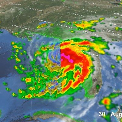
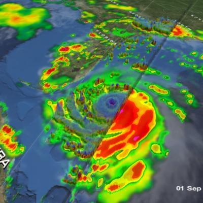
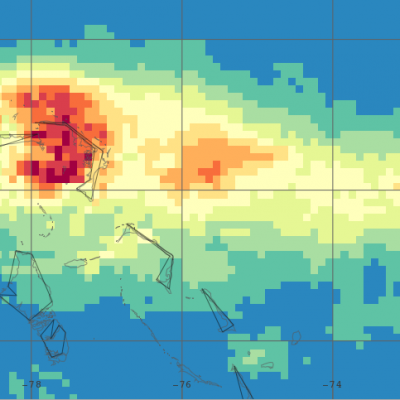
Download in high resolution from the NASA Goddard Scientific Visualization Studio GPM captured Dorian at 10:41 UTC (6:41 am EDT) on the 4th of September when the storm was moving north-northwest parallel to the coast of Florida about 90 miles due east of Daytona Beach. Three days earlier, Dorian had struck the northern Bahamas as one of the most powerful Category 5 hurricanes on record in the Atlantic with sustained winds of 185 mph. Weakening steering currents allowed the powerful storm to ravage the northern Bahamas for 2 full days. During this time, Dorian began to weaken due to its...
GPM Observes Hurricane Dorian Over Bahamas
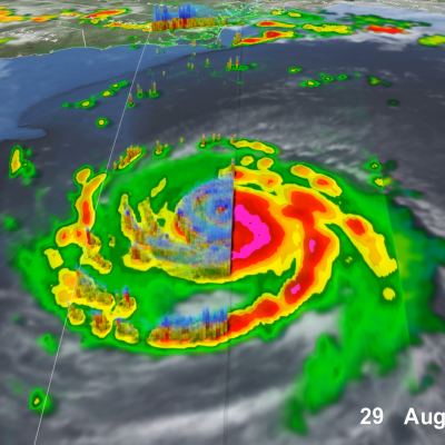
Download in high resolution from the NASA Goddard Scientific Visualization Studio. The NASA / JAXA Global Precipitation Measurement (GPM) Core Observatory flew over Hurricane Dorian on September 1st (5:22pm ET / 21:22 UTC) as the storm was directly over Abaco Island in The Bahamas. The satellite captured data on rainfall rates within the storm as it flew over using its Dual-frequency Precipitation Radar (DPR) and GPM Microwave Imager (GMI). In this animation the multi-satellite GPM IMERG product is shown first to illustrate rainfall rates prior to the overpass. When the camera zooms in data...
Hurricane Dorian Brings Heavy Rain to Bahamas
In addition to the powerful winds that have raked the northern Bahamas over the past few days, Hurricane Dorian’s slow motion has brought very heavy rainfall to the islands as well. Dorian first formed into a tropical depression on the 24th of August about 800 miles east southeast of Barbados in the Lesser Antilles from an area of low pressure; the depression was quickly upgraded to a minimal tropical storm and named Dorian by the National Hurricane Center (NHC) later in the day. As Dorian made its way westward under the influence of a high pressure ridge to the north, it was held in check...
IMERG Measures Rainfall in Hurricane Dorian
UPDATE 9/9/19: On Monday morning, September 9, Hurricane Dorian was a post-tropical storm after a mid-latitude weather front and cold seas had altered its tropical characteristics over the weekend. On Saturday and Sunday, Hurricane Dorian struck eastern Canada, causing wind damage and bringing heavy rainfall. According to the Associated Press, a peak of 400,000 people were without power in Nova Scotia, Canada, because of Dorian. This graphic shows precipitation that fell during the almost two-week period from August 27 to the early hours of September 9. The near-realtime rain estimates come...
5 Year Anniversary of Hurricane Arthur
TRMM overpass of Hurricane Arthur from July 3, 2014. View fullscreen in STORM Event Viewer June marks the official start of the Atlantic hurricane season. And although strong tropical cyclones are rare in June in the Atlantic, it will soon be the 5-year anniversary of Hurricane Arthur, which became a tropical depression in very late June 2014 before hitting the Outer Banks of North Carolina as a Category 2 hurricane in early July. As with most storms early in the season, Arthur formed not from a tropical wave moving off the coast of Africa but from an old frontal boundary that stalls off the...
GPM Catches Typhoon Yutu Making Landfall
NASA's GPM Core observatory satellite captured an image of Super Typhoon Yutu when it flew over the powerful storm just as the center was striking the central Northern Mariana Islands north of Guam. Early Thursday, Oct. 25 local time, Super Typhoon Yutu crossed over the U.S. commonwealth of the Northern Mariana Islands. It was the equivalent of a Category 5 hurricane. The National Weather Service in Guam said it was the strongest storm to hit any part of the U.S. this year. Download this video in high resolution from the NASA Goddard Scientific Visualization Studio Download video without...
Dive Into a 360-View of Hurricane Maria
Two days before Hurricane Maria devastated Puerto Rico, the NASA/JAXA Global Precipitation Measurement Core Observatory satellite captured a 3D view of the 2017 storm. At the time Maria was a category 1 hurricane. The 3-D view reveals the processes inside the hurricane that would fuel the storm’s intensification to a category 5 storm within 24 hours. For the first time in 360 degrees, this data visualization takes you inside the hurricane. The precipitation satellite has an advanced radar that measures both liquid and frozen water. The brightly colored dots show areas of rainfall, where green...
GPM Flies Over Tropical Cyclone Florence
Download in High Resolution from the NASA Goddard Scientific Visualization Studio GPM passed over Tropical Storm Florence on September 7, 2018. As the camera moves in on the storm, DPR's volumetric view of the storm is revealed. A slicing plane moves across the volume to display precipitation rates throughout the storm. Shades of green to red represent liquid precipitation. Frozen precipitation is shown in cyan and purple. NASA's Global Precipitation Measurement mission or GPM core observatory satellite flew over Tropical Storm Florence on September 7, 2018. At that time, the storm was...
GPM Sees Powerful Winter Storm Grayson
Powerful Coastal Storm Brings Snow, Extreme Cold, Wind and Blizzard Conditions to the East Coast View an interactive 3D visualization of GPM data from Winter Storm Grayson in STORM Event Viewer Mobile version Cold Artic air has been keeping the vast majority of the country east of the Rockies in the deep freeze over the past week. Now a powerful coastal storm is working its way up the East Coast bringing a mixture of snow, freezing rain, high winds and blizzard conditions from as far south as Florida all the way up into Maine with blizzard warnings in effect along the coast from North Carolina...
GPM Catches Nor'easter over New England
At the time of the Global Precipitation Measurement (GPM) Core Observatory overpass (April 1, 2017, 0550 UTC), the storm's center of low pressure was south of Long Island. At the mid-levels of the atmosphere, the circulation was centered over northeast Pennsylvania. This led to a classic overrunning, warm conveyor setup, which happened when the counterclockwise low level flow drew in cold air out of the north/northeast (hence "Nor'easter") from Canada. Higher up, warm and moist air from further south was lifted over this cold air and resulted in precipitation in the form of snow at the surface...

Through rain and snow, hurricane, typhoon and monsoon, flash flood and bomb cyclone, for ten years, the joint NASA-JAXA Global Precipitation Measurement mission has measured a lot of water. GPM’s Core Observatory satellite launched from Tanegashima Space Center in Japan in early 2014, becoming the first satellite to be able to see through the clouds and measure liquid and frozen precipitation from the Equator to polar regions using a radar. Now in its tenth year of operation, we look at ten events brought to light by this groundbreaking mission. Credits: NASA's Goddard Space Flight Center

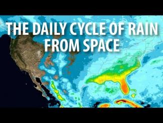
The most detailed view of our daily weather has been created using NASA's newest extended precipitation record known as the Integrated Multi-satellitE Retrievals for GPM, or IMERG analysis. The IMERG analysis combines almost 20 years of rain and snow data from the Tropical Rainfall Measuring Mission (TRMM) and the joint NASA-JAXA Global Precipitation Measurement mission (GPM). The daily cycle of weather, also known as the diurnal cycle, shapes how and when our weather develops and is fundamental to regulating our climate.

Music Credits: "Battle For Our Future" and "Wonderful Orbit" by Tom...

NASA engineer Manuel Vega can see one of the Olympic ski jump towers from the rooftop of the South Korean weather office where he is stationed. Vega is not watching skiers take flight, preparing for the 2018 PyeongChang Winter Olympics and Paralympic games. Instead, he’s inspecting the SUV-sized radar beside him. The instrument is one 11 NASA instruments specially transported to the Olympics to measure the quantity and type of snow falling on the slopes, tracks and halfpipes. NASA will make these observations as one of 20 agencies from eleven countries in the Republic of Korea as participants...

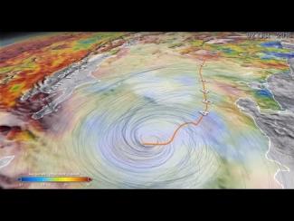
NASA researchers now can use a combination of satellite observations to re-create multi-dimensional pictures of hurricanes and other major storms in order to study complex atmospheric interactions. In this video, they applied those techniques to Hurricane Matthew. When it occurred in the fall of 2016, Matthew was the first Category 5 Atlantic hurricane in almost ten years. Its torrential rains and winds caused significant damage and loss of life as it coursed through the Caribbean and up along the southern U.S. coast. 

Music: "Buoys," Donn Wilkerson, Killer Tracks; "Late Night Drive," Donn...

NASA scientists can measure the size and shape distribution of snow particles, layer by layer, in a storm. The Global Precipitation Measurement mission is an international satellite project that provides next-generation observations of rain and snow worldwide every three hours.

Hide Body

Hide Date